|
|
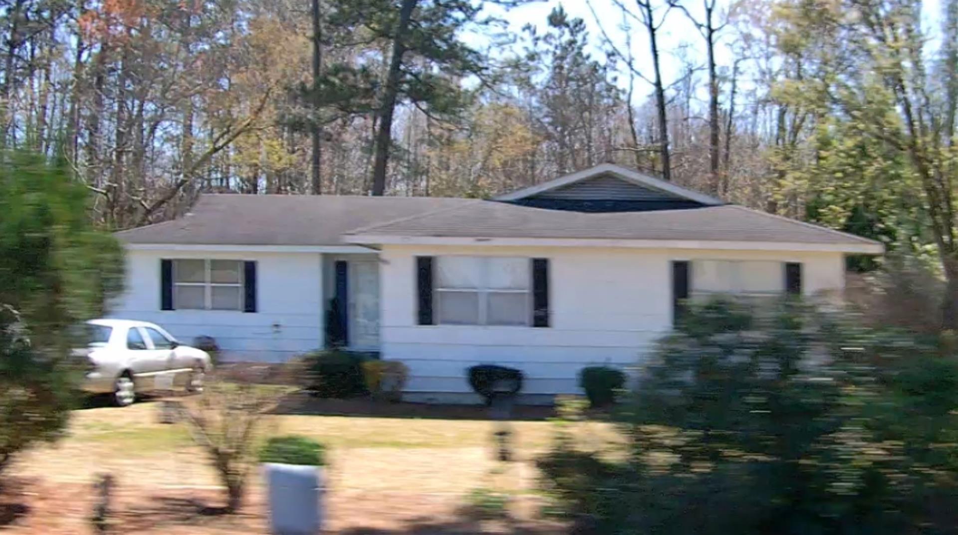
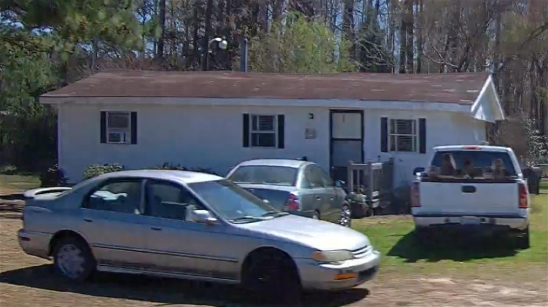
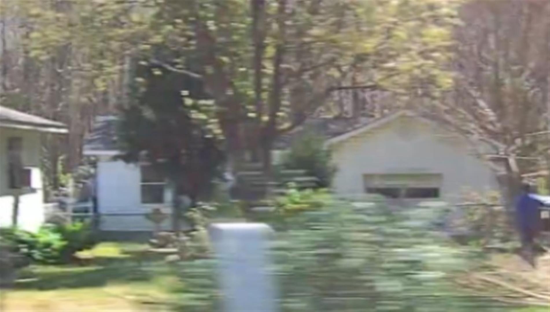
| 4624 ROSEBUD CHURCH RD |
|
| ELM CITY , NC 27822-8216 |
|
| Property
Location Address |
|
| Parcel
ID No. |
3743561162.000 |
| PIN |
3743 56 1162 000 |
| Owner ID |
79897900 |
| |
|
| Tax
District |
23 - C/SW/TOISNOT FD |
| |
| Land Use Code |
50 |
| Land Use Desc |
RURAL HOMESITE |
| |
|
| Neighborhood |
8121 - GARDNERS |
|
| Legal
Desc |
4624 ROSEBUD CHURCH RD |
| |
.77AC |
| |
|
| Deed
Year Bk/Pg |
1987 - 1339 / 764 |
| Plat
Bk/Pg |
/ |
| |
Sales
Information |
| |
| Grantor |
|
| |
|
| Sold
Date |
0--0 |
| Sold
Amount $ |
0 |
|
| |
| Market Value $ |
238,772
|
| |
|
Market
Value - Land and all permanent improvements,
if any, effective January 1, 2024, date
of County’s most recent General Reappraisal
|
|
| |
|
| Assessed Value $ |
238,772
|
| |
If
Assessed Value not equal Market Value then
subject parcel designated as a special
class -agricultural, horticultural, or
forestland and thereby eligible for taxation
on basis of Present-Use.
|
|
|
| Year
Built |
1979 |
| Built
Use/Style |
SFR-1.0 STY |
| Grade |
C+05 / C+05 GRADE |
| * Percent
Complete |
100 |
| Heated
Area (S/F) |
1,796 |
| Fireplace
(Y/N) |
N |
| Basement
(Y/N) |
N |
| ** Bedroom(s) |
4 |
| ** Bathroom(s) |
2 Full Bath(s) 0 Half Bath(s) |
| *** Multiple
Improvements |
003 |
*
Note - As of January 1
*
* Note - Bathroom(s), Bedroom(s), shown for description
only
* * * Note - If multiple improvements equal “MLT” then
parcel includes additional major improvements |
|
| Building
Sketch - NOTE: Sketches are updated the first day of every month. |
|
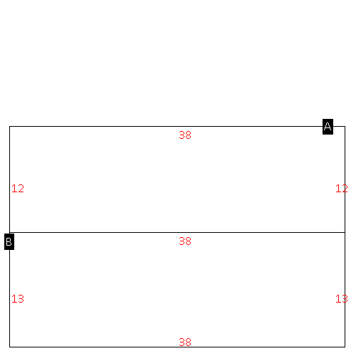
(Building 1) - Sketch for Parcel ID: 3743561162.000
NOTE: Sketches are updated the first day of every month.
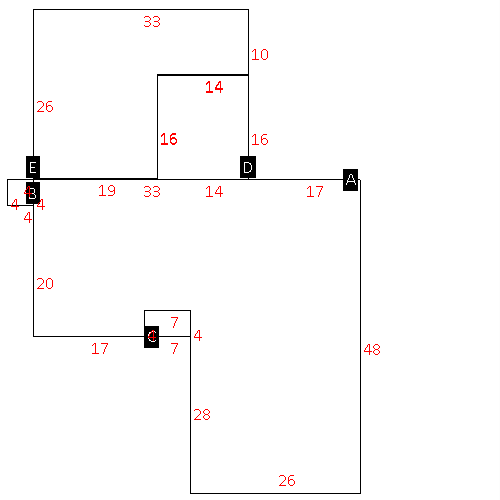 |
| Label |
Description |
Base SF |
Total SF |
| A |
SFR-1.0 STY |
1796.00 |
1796.00 |
| B |
STOOP-MAS |
16.00 |
.00 |
| C |
PORCH-OPEN-MAS |
28.00 |
.00 |
| D |
STOOP-MAS |
224.00 |
.00 |
| E |
PATIO-CONC |
634.00 |
.00 |
|
|
(Building 2) - Sketch for Parcel ID: 3743561162.000
NOTE: Sketches are updated the first day of every month.
 |
| Label |
Description |
Base SF |
Total SF |
| A |
MFG-SINGLE WIDE |
456.00 |
456.00 |
| B |
SFR-ADDT FR |
494.00 |
494.00 |
|
|
(Building 3) - Sketch for Parcel ID: 3743561162.000
NOTE: Sketches are updated the first day of every month.
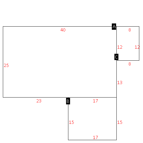 |
| Label |
Description |
Base SF |
Total SF |
| A |
BATH HOUSE |
1000.00 |
1000.00 |
| B |
GARAGE-ATT-FR |
255.00 |
.00 |
| C |
UTILITY STG-FR |
96.00 |
.00 |
|
|
|
|
|
| Map Acres |
0.77 |
| Tax District Note |
23 - C/SW/TOISNOT FD |
| Present-Use Info |
RURAL HOMESITE |
| Zoning Code |
AR |
| Zoning Desc |
AGRICUL-RESID 40M SF |
|
| Total Improvements Valuation
|
*Total Improvements Full Market Value $
|
**Total Improvements Assessed Value
|
216,227
|
216,227
|
*
Note - Market Value effective Date equal January 1, 2024, date of County’s most recent General
Reappraisal
** Note - If Assessed Value not equal Market Value then variance
resulting from formal appeal procedure |
|
| Land
Value Detail (Effective Date January 1, 2024, date
of County’s most recent General Reappraisal) |
Land
Full Value (LFV) $
|
Land
Present-Use Value (PUV) $ **
|
Land
Total Assessed Value $
|
22,545
|
22,545
|
22,545
|
| **
Note: If PUV equal LMV then parcel has
not qualified for present use program |
|
| Land
Detail (Effective Date January 1, 2024, date of County’s
most recent General Reappraisal) |
Rate Type |
Rate Code |
Description |
Quantity |
AC |
5010 |
RURAL HOMESITE PAVED |
.770 |
|
|
|
.000 |
|
|
|
|