|
|
| 11124 CHRISTIAN RD |
|
| WILSON , NC 27896-6098 |
|
| Property
Location Address |
| 7359 SHALLINGTONS MILL RD |
|
| Parcel
ID No. |
3774215115.000 |
| PIN |
3774 21 5115 000 |
| Owner ID |
69951026 |
| |
|
| Tax
District |
25 - C/SW/BAKERTOWN FD |
| |
| Land Use Code |
10 |
| Land Use Desc |
COMMERICAL |
| |
|
| Neighborhood |
8121 - GARDNERS |
|
| Legal
Desc |
7359 SHALLINGTONS MILL RD |
| |
325.47AC |
| |
|
| Deed
Year Bk/Pg |
2011 - 2433 / 648 |
| Plat
Bk/Pg |
38 / 118 |
| |
Sales
Information |
| |
| Grantor |
|
| |
|
| Sold
Date |
0--0 |
| Sold
Amount $ |
0 |
|
| |
| Market Value $ |
1,014,103
|
| |
|
Market
Value - Land and all permanent improvements,
if any, effective January 1, 2024, date
of County’s most recent General Reappraisal
|
|
| |
|
| Assessed Value $ |
698,730
|
| |
If
Assessed Value not equal Market Value then
subject parcel designated as a special
class -agricultural, horticultural, or
forestland and thereby eligible for taxation
on basis of Present-Use.
|
|
|
| Year
Built |
2001 |
| Built
Use/Style |
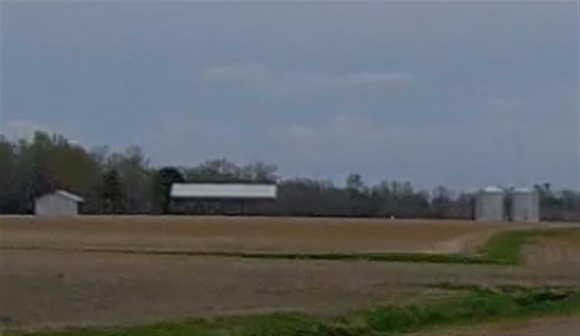
WAREHOUSE |
| Grade |
D+05 / D+05 GRADE |
| * Percent
Complete |
100 |
| Heated
Area (S/F) |
15,520 |
| Fireplace
(Y/N) |
N |
| Basement
(Y/N) |
N |
| ** Bedroom(s) |
0 |
| ** Bathroom(s) |
0 Full Bath(s) 0 Half Bath(s) |
| *** Multiple
Improvements |
001 |
*
Note - As of January 1
*
* Note - Bathroom(s), Bedroom(s), shown for description
only
* * * Note - If multiple improvements equal “MLT” then
parcel includes additional major improvements |
|
| Photo |
Photo 1
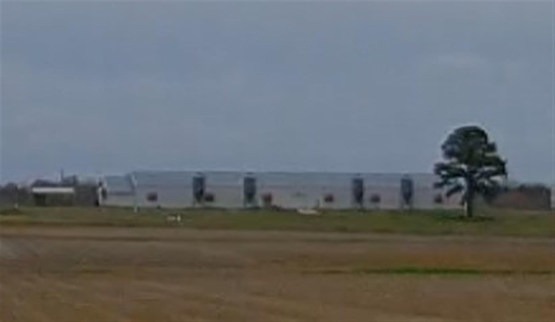 Photo 2
|
|
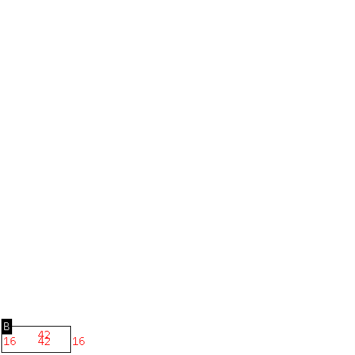
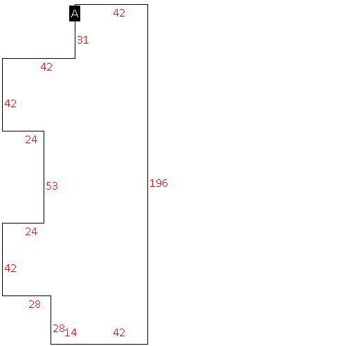
| Building
Sketch - NOTE: Sketches are updated the first day of every month. |
|
(Building 1) - Sketch for Parcel ID: 3774215115.000
NOTE: Sketches are updated the first day of every month.
 |
| Label |
Description |
Base SF |
Total SF |
|
|
(Building 2) - Sketch for Parcel ID: 3774215115.000
NOTE: Sketches are updated the first day of every month.
 |
| Label |
Description |
Base SF |
Total SF |
|
|
|
|
|
| Map Acres |
325.47 |
| Tax District Note |
25 - C/SW/BAKERTOWN FD |
| Present-Use Info |
COMMERICAL |
| Zoning Code |
AR |
| Zoning Desc |
AGRICUL-RESID 40M SF |
|
| Total Improvements Valuation
|
*Total Improvements Full Market Value $
|
**Total Improvements Assessed Value
|
288,136
|
288,136
|
*
Note - Market Value effective Date equal January 1, 2024, date of County’s most recent General
Reappraisal
** Note - If Assessed Value not equal Market Value then variance
resulting from formal appeal procedure |
|
| Land
Value Detail (Effective Date January 1, 2024, date
of County’s most recent General Reappraisal) |
Land
Full Value (LFV) $
|
Land
Present-Use Value (PUV) $ **
|
Land
Total Assessed Value $
|
725,967
|
410,594
|
410,594
|
| **
Note: If PUV equal LMV then parcel has
not qualified for present use program |
|
| Land
Detail (Effective Date January 1, 2024, date of County’s
most recent General Reappraisal) |
Rate Type |
Rate Code |
Description |
Quantity |
AC |
5111 |
MKT OPEN LD PVD CLASS 1 |
195.250 |
LU |
5110 |
|
195.250 |
AC |
5211 |
MKT OPEN LD PVD CLASS 2 |
1.300 |
LU |
5210 |
|
1.300 |
AC |
5311 |
MKT OPEN LD PVD CLASS 3 |
6.920 |
LU |
5310 |
|
6.920 |
AC |
6111 |
MKT WOODS PVD CLASS 1 |
122.000 |
|
|
|
.000 |
|
|
|
|
