|
|
| PO BOX 38 |
|
| BLACK CREEK , NC 27813-0038 |
|
| Property
Location Address |
|
| Parcel
ID No. |
3618436790.000 |
| PIN |
3618 43 6790 000 |
| Owner ID |
69926903 |
| |
|
| Tax
District |
16 - C/SW/LEE WOODARD FD |
| |
| Land Use Code |
50 |
| Land Use Desc |
RURAL HOMESITE |
| |
|
| Neighborhood |
8030 - BLACK_CREEK_RA |
|
| Legal
Desc |
715 CHURCH ST |
| |
HARDY BASS FM 46.24AC |
| |
|
| Deed
Year Bk/Pg |
1993 - 93E / 157 |
| Plat
Bk/Pg |
/ |
| |
Sales
Information |
| |
| Grantor |
|
| |
|
| Sold
Date |
0--0 |
| Sold
Amount $ |
0 |
|
| |
| Market Value $ |
155,298
|
| |
|
Market
Value - Land and all permanent improvements,
if any, effective January 1, 2024, date
of County’s most recent General Reappraisal
|
|
| |
|
| Assessed Value $ |
109,407
|
| |
If
Assessed Value not equal Market Value then
subject parcel designated as a special
class -agricultural, horticultural, or
forestland and thereby eligible for taxation
on basis of Present-Use.
|
|
|
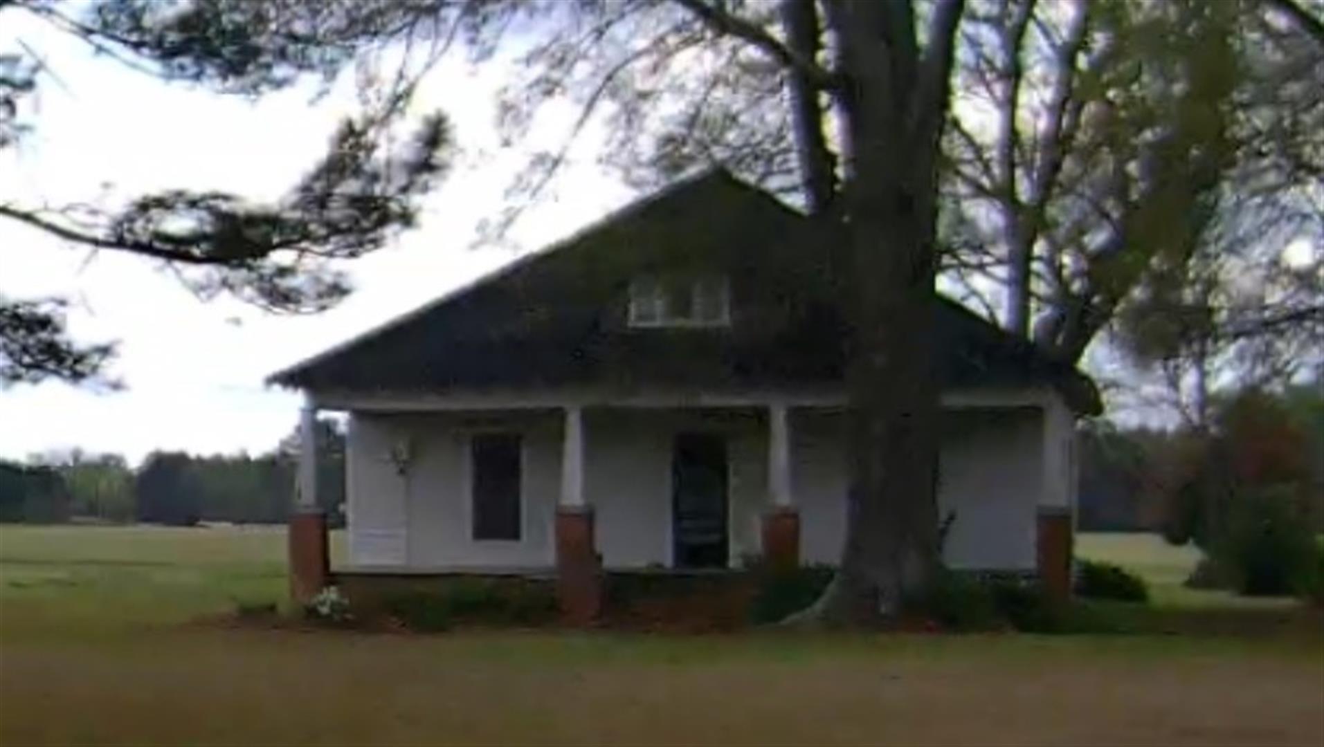
| Year
Built |
1910 |
| Built
Use/Style |
SFR-1.0 STY |
| Grade |
D+05 / D+05 GRADE |
| * Percent
Complete |
100 |
| Heated
Area (S/F) |
1,536 |
| Fireplace
(Y/N) |
N |
| Basement
(Y/N) |
N |
| ** Bedroom(s) |
3 |
| ** Bathroom(s) |
1 Full Bath(s) 0 Half Bath(s) |
| *** Multiple
Improvements |
001 |
*
Note - As of January 1
*
* Note - Bathroom(s), Bedroom(s), shown for description
only
* * * Note - If multiple improvements equal “MLT” then
parcel includes additional major improvements |
|
| Photo |
Photo 1
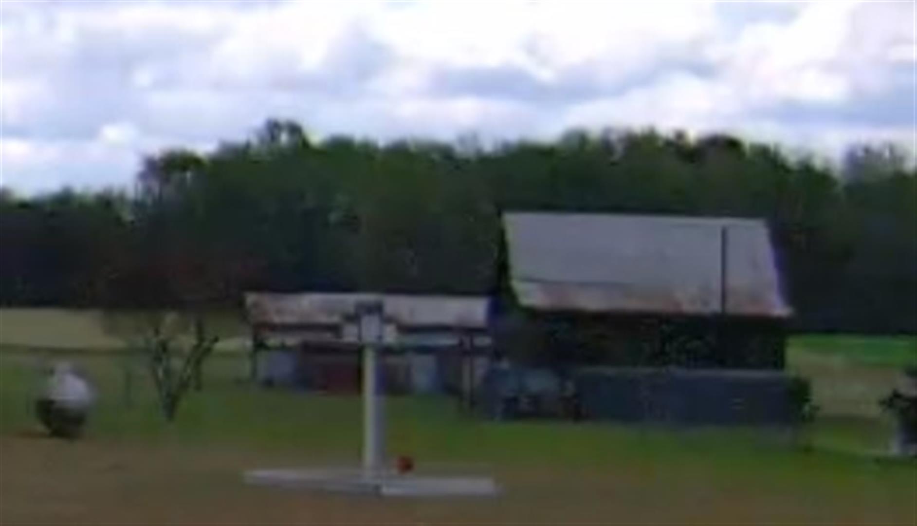 Photo 2
|
|
| Building
Sketch - NOTE: Sketches are updated the first day of every month. |
|
(Building 1) - Sketch for Parcel ID: 3618436790.000
NOTE: Sketches are updated the first day of every month.
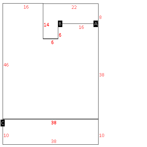 |
| Label |
Description |
Base SF |
Total SF |
| A |
SFR-1.0 STY |
1536.00 |
1536.00 |
| B |
PORCH-OPEN-FR |
212.00 |
.00 |
| C |
PORCH-OPEN-FR |
380.00 |
.00 |
|
|
|
|
|
| Map Acres |
46.24 |
| Tax District Note |
16 - C/SW/LEE WOODARD FD |
| Present-Use Info |
RURAL HOMESITE |
| Zoning Code |
RA |
| Zoning Desc |
RESIDENTAL AGRICULTURAL |
|
| Total Improvements Valuation
|
*Total Improvements Full Market Value $
|
**Total Improvements Assessed Value
|
60,647
|
60,647
|
*
Note - Market Value effective Date equal January 1, 2024, date of County’s most recent General
Reappraisal
** Note - If Assessed Value not equal Market Value then variance
resulting from formal appeal procedure |
|
| Land
Value Detail (Effective Date January 1, 2024, date
of County’s most recent General Reappraisal) |
Land
Full Value (LFV) $
|
Land
Present-Use Value (PUV) $ **
|
Land
Total Assessed Value $
|
94,651
|
48,760
|
48,760
|
| **
Note: If PUV equal LMV then parcel has
not qualified for present use program |
|
| Land
Detail (Effective Date January 1, 2024, date of County’s
most recent General Reappraisal) |
Rate Type |
Rate Code |
Description |
Quantity |
AC |
5010 |
RURAL HOMESITE PAVED |
1.000 |
|
|
|
.000 |
AC |
5111 |
MKT OPEN LD PVD CLASS 1 |
11.300 |
LU |
5110 |
|
11.300 |
AC |
5211 |
MKT OPEN LD PVD CLASS 2 |
7.160 |
LU |
5210 |
|
7.160 |
AC |
6111 |
MKT WOODS PVD CLASS 1 |
16.780 |
LU |
6110 |
|
16.780 |
AC |
6211 |
MKT WOODS PVD CLASS 2 |
10.000 |
LU |
6210 |
|
10.000 |
|
|
|
|
