|
|
| 4957 RALEIGH ROAD PKWY W |
|
| WILSON , NC 27896-9701 |
|
| Property
Location Address |
|
| Parcel
ID No. |
2793415379.01 |
| PIN |
2793 41 5379 000 |
| Owner ID |
54462784 |
| |
|
| Tax
District |
31 - C/CIWI-WILSON |
| |
| Land Use Code |
01 |
| Land Use Desc |
SINGLE FAMILY RESIDENTIAL |
| |
|
| Neighborhood |
8247 - RALEIGH_ROAD_PKWY-I_95_B- |
|
| Legal
Desc |
5105 RALEIGH ROAD PKWY W |
| |
TR-1A&2A&2&3 15.84AC CITY |
| |
|
| Deed
Year Bk/Pg |
2008 - 84E / 219 |
| Plat
Bk/Pg |
3 / 135 |
| |
Sales
Information |
| |
| Grantor |
|
| |
|
| Sold
Date |
0--0 |
| Sold
Amount $ |
0 |
|
| |
| Market Value $ |
1,425,523
|
| |
|
Market
Value - Land and all permanent improvements,
if any, effective January 1, 2024, date
of County’s most recent General Reappraisal
|
|
| |
|
| Assessed Value $ |
507,459
|
| |
If
Assessed Value not equal Market Value then
subject parcel designated as a special
class -agricultural, horticultural, or
forestland and thereby eligible for taxation
on basis of Present-Use.
|
|
|
| Year
Built |
1935 |
| Built
Use/Style |
SFR-1.0 STY |
| Grade |
C-10 / C-10 GRADE |
| * Percent
Complete |
100 |
| Heated
Area (S/F) |
1,715 |
| Fireplace
(Y/N) |
N |
| Basement
(Y/N) |
N |
| ** Bedroom(s) |
3 |
| ** Bathroom(s) |
1 Full Bath(s) 0 Half Bath(s) |
| *** Multiple
Improvements |
004 |
*
Note - As of January 1
*
* Note - Bathroom(s), Bedroom(s), shown for description
only
* * * Note - If multiple improvements equal “MLT” then
parcel includes additional major improvements |
|
| Photo |
Photo 1
 Photo 2
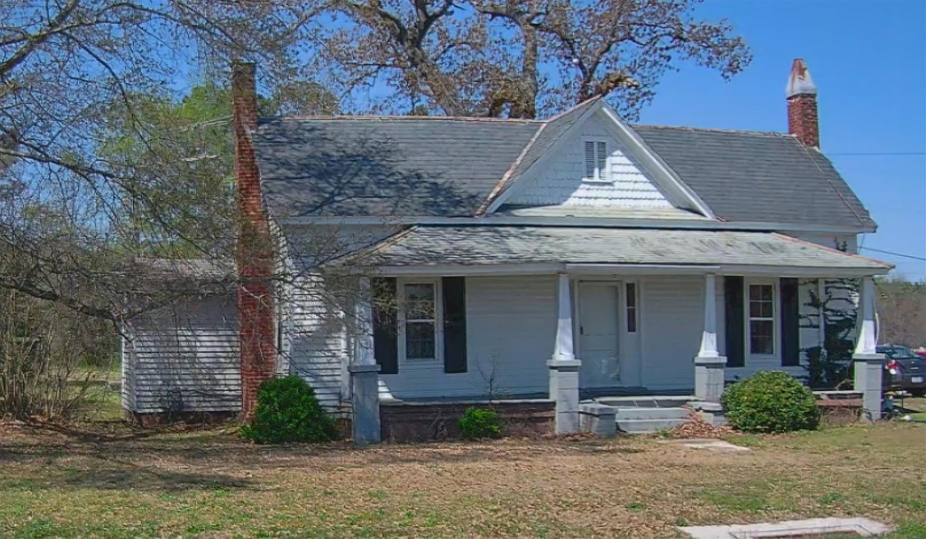 Photo 3
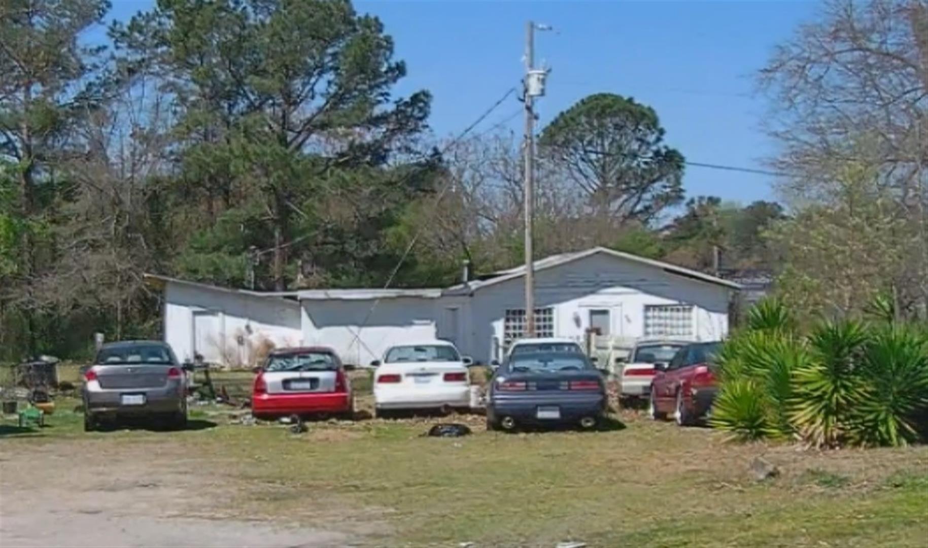 Photo 1
|
|
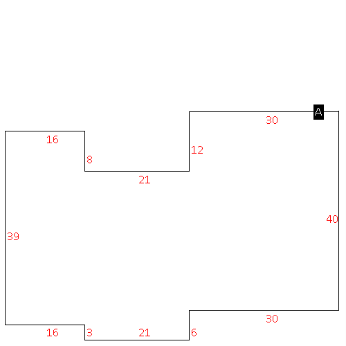
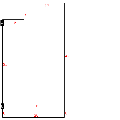
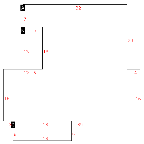
| Building
Sketch - NOTE: Sketches are updated the first day of every month. |
|
(Building 1) - Sketch for Parcel ID: 2793415379.01
NOTE: Sketches are updated the first day of every month.
 |
| Label |
Description |
Base SF |
Total SF |
|
|
(Building 2) - Sketch for Parcel ID: 2793415379.01
NOTE: Sketches are updated the first day of every month.
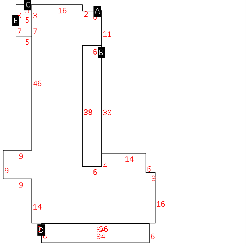 |
| Label |
Description |
Base SF |
Total SF |
| A |
COMMERCIAL-MISC |
2538.00 |
2538.00 |
|
|
(Building 3) - Sketch for Parcel ID: 2793415379.01
NOTE: Sketches are updated the first day of every month.
 |
| Label |
Description |
Base SF |
Total SF |
|
|
(Building 4) - Sketch for Parcel ID: 2793415379.01
NOTE: Sketches are updated the first day of every month.
 |
| Label |
Description |
Base SF |
Total SF |
| A |
SFR-1.0 STY |
1715.00 |
1715.00 |
| B |
PORCH-SCR-MAS |
228.00 |
.00 |
| C |
UTILITY STG-FR |
15.00 |
.00 |
| D |
PORCH-OPEN-FR |
204.00 |
.00 |
| E |
PORCH-SCR-MAS |
35.00 |
.00 |
|
|
|
|
|
| Map Acres |
15.84 |
| Tax District Note |
31 - C/CIWI-WILSON |
| Present-Use Info |
SINGLE FAMILY RESIDENTIAL |
| Zoning Code |
GC |
| Zoning Desc |
GEN COMMERCIAL |
|
| Total Improvements Valuation
|
*Total Improvements Full Market Value $
|
**Total Improvements Assessed Value
|
183,541
|
183,541
|
*
Note - Market Value effective Date equal January 1, 2024, date of County’s most recent General
Reappraisal
** Note - If Assessed Value not equal Market Value then variance
resulting from formal appeal procedure |
|
| Land
Value Detail (Effective Date January 1, 2024, date
of County’s most recent General Reappraisal) |
Land
Full Value (LFV) $
|
Land
Present-Use Value (PUV) $ **
|
Land
Total Assessed Value $
|
1,241,982
|
323,918
|
323,918
|
| **
Note: If PUV equal LMV then parcel has
not qualified for present use program |
|
| Land
Detail (Effective Date January 1, 2024, date of County’s
most recent General Reappraisal) |
Rate Type |
Rate Code |
Description |
Quantity |
SF |
0700 |
COMMERCIAL |
174240.000 |
|
|
|
.000 |
SF |
0700 |
COMMERCIAL |
378536.400 |
LU |
5120 |
|
8.690 |
SF |
0700 |
COMMERCIAL |
137214.000 |
LU |
5220 |
|
3.150 |
|
|
|
|
