| PRIDGEN MARION LAFAYETTE JR |
| |
|
| PO BOX 1553 |
|
| WILSON , NC 27893-1553 |
|
| Property
Location Address |
|
| Parcel
ID No. |
3742405714.000 |
| PIN |
3742 40 5714 000 |
| Previous Parcel |
3742302601.000 |
| Owner ID |
17248540 |
| |
|
| Tax
District |
12 - C/SW/EAST NASH FD |
| |
| Land Use Code |
50 |
| Land Use Desc |
RURAL HOMESITE |
| |
|
| Neighborhood |
8121 - GARDNERS |
|
| Legal
Desc |
4200 TARTTS MILL RD |
| |
L1L2L3&PB 19-54 164.27AC |
| |
|
| Deed
Year Bk/Pg |
2022 - 2970 / 869 |
| Plat
Bk/Pg |
3 / 24 |
| |
Sales
Information |
| |
| Grantor |
PRIDGEN MARION LAFAYETTE JR |
| |
|
| Sold
Date |
2022-06-28 |
| Sold
Amount $ |
0 |
|
| |
| Market Value $ |
1,346,538
|
| |
|
Market
Value - Land and all permanent improvements,
if any, effective January 1, 2024, date
of County’s most recent General Reappraisal
|
|
| |
|
| Assessed Value $ |
1,048,789
|
| |
If
Assessed Value not equal Market Value then
subject parcel designated as a special
class -agricultural, horticultural, or
forestland and thereby eligible for taxation
on basis of Present-Use.
|
|
|
| Year
Built |
1925 |
| Built
Use/Style |
SFR-1.0 STY |
| Grade |
C-05 / C-05 GRADE |
| * Percent
Complete |
100 |
| Heated
Area (S/F) |
1,174 |
| Fireplace
(Y/N) |
Y |
| Basement
(Y/N) |
N |
| ** Bedroom(s) |
3 |
| ** Bathroom(s) |
1 Full Bath(s) 0 Half Bath(s) |
| *** Multiple
Improvements |
003 |
*
Note - As of January 1
*
* Note - Bathroom(s), Bedroom(s), shown for description
only
* * * Note - If multiple improvements equal “MLT” then
parcel includes additional major improvements |
|
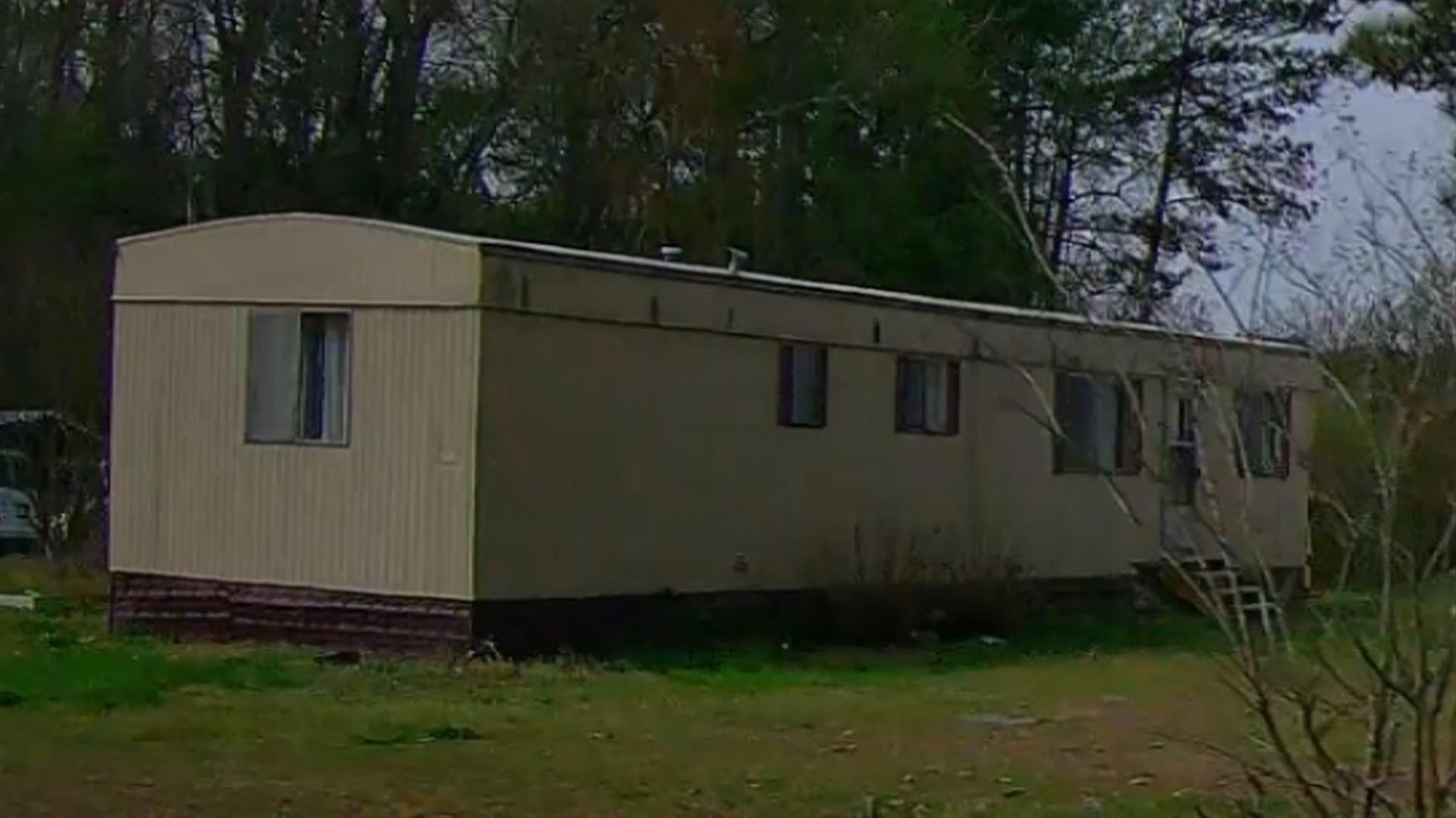
| Photo |
Photo 1
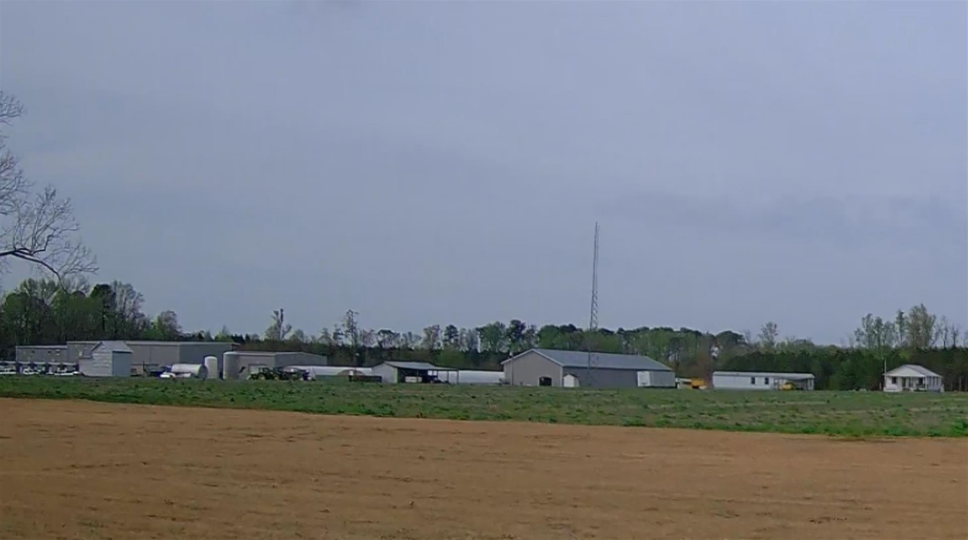 Photo 2
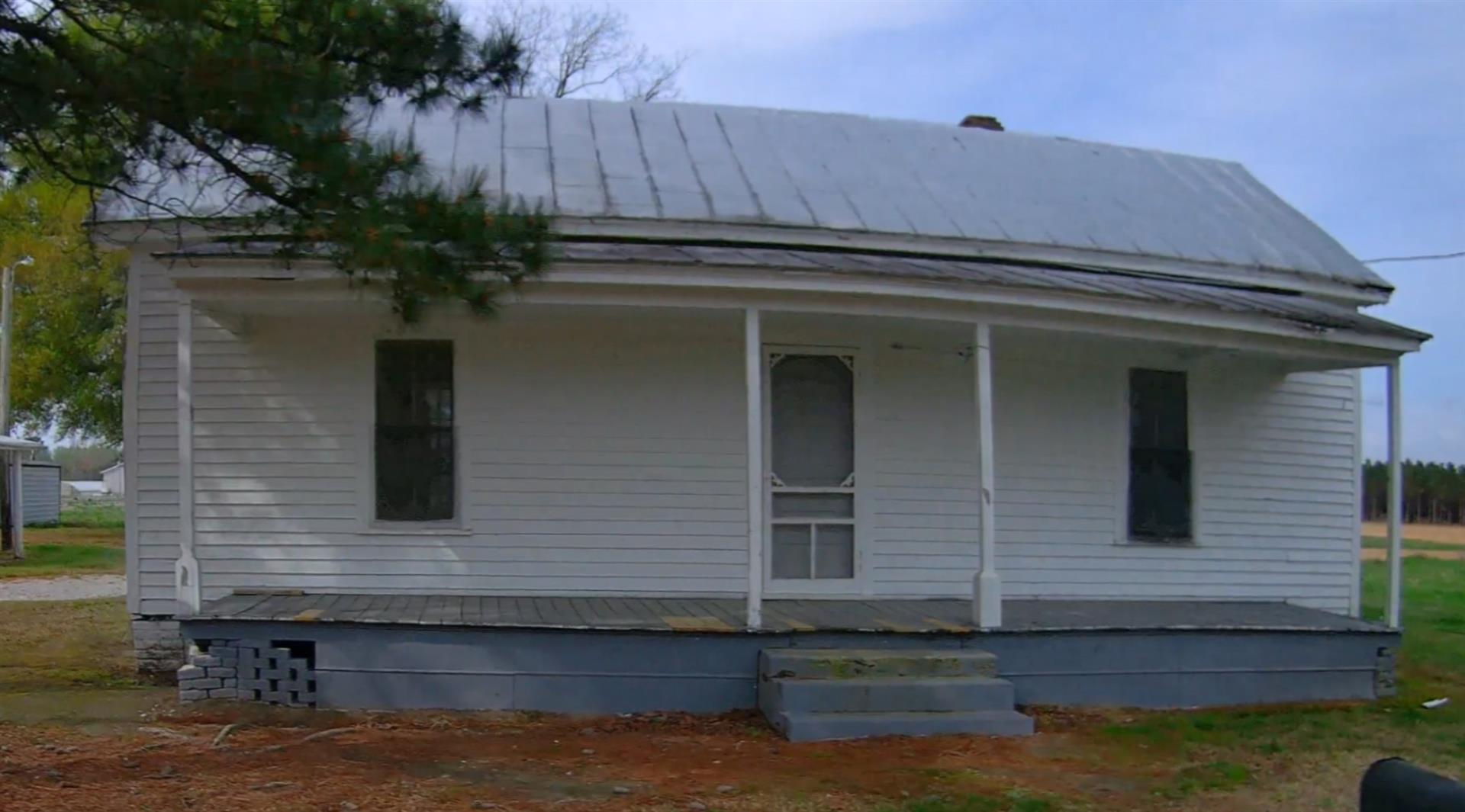 Photo 3
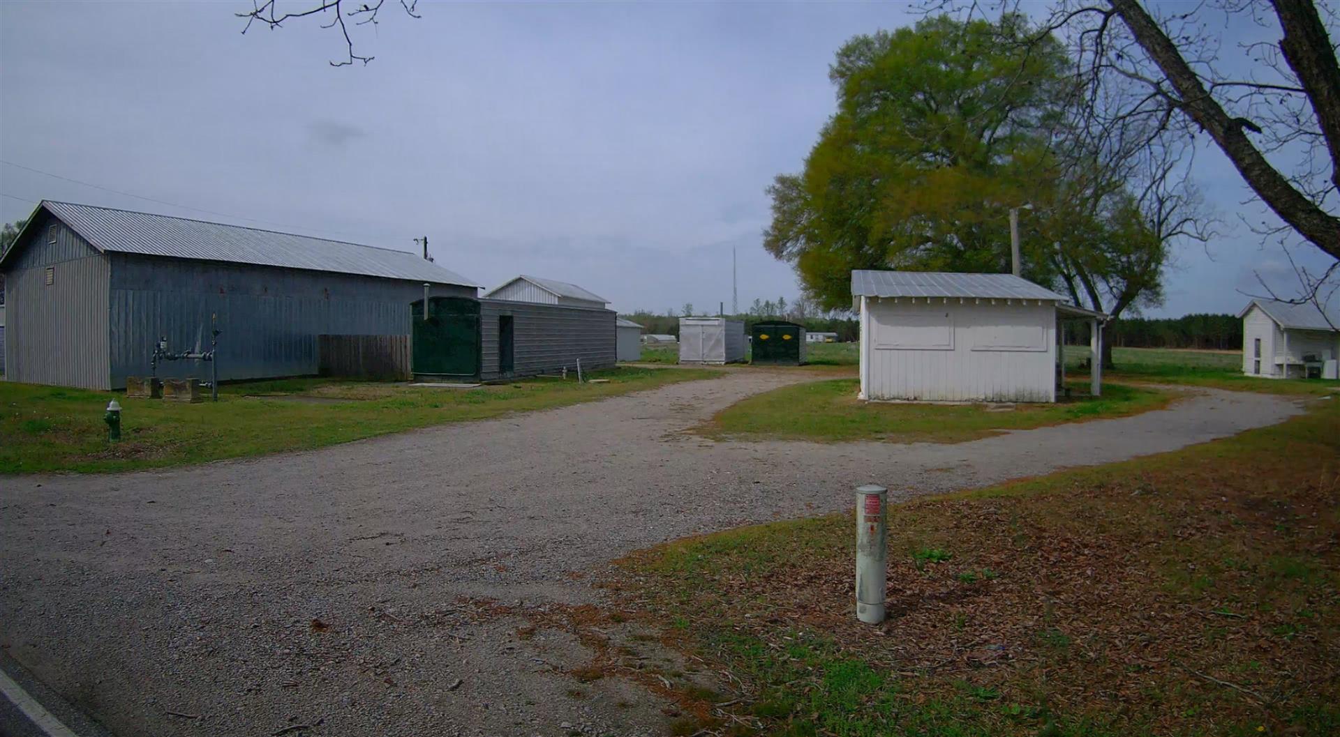 Photo 4
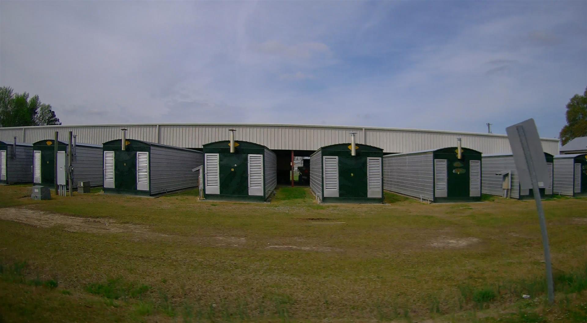 Photo 5
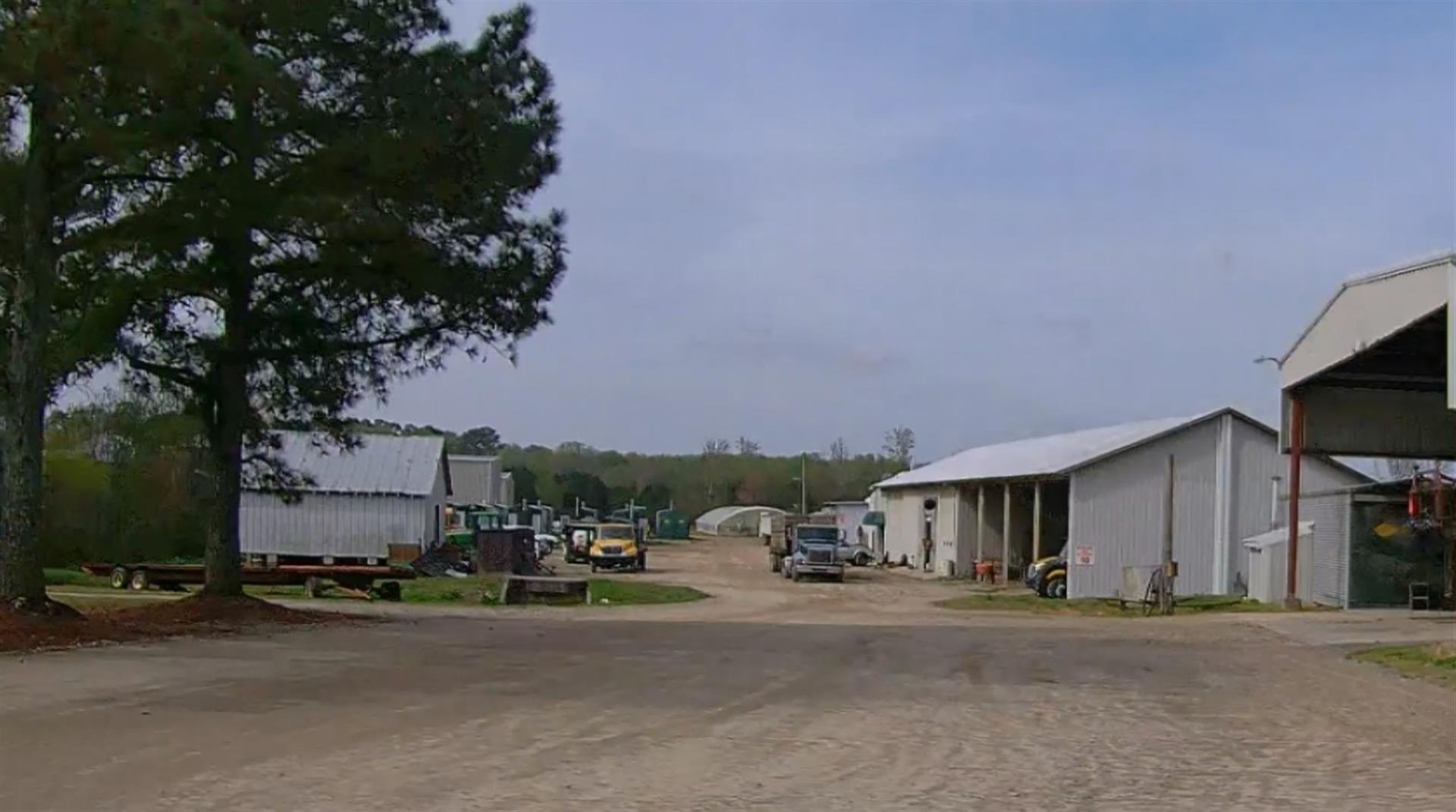 Photo 1
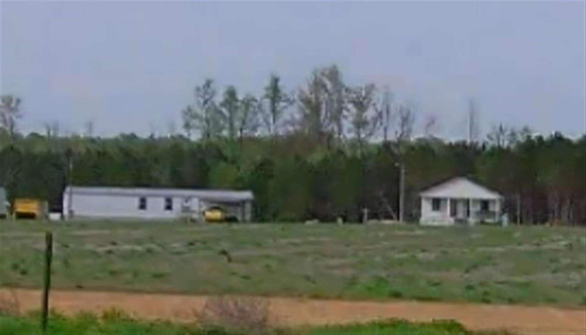 Photo 1
|
|
| Building
Sketch - NOTE: Sketches are updated the first day of every month. |
|
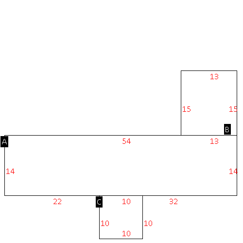
(Building 1) - Sketch for Parcel ID: 3742405714.000
NOTE: Sketches are updated the first day of every month.
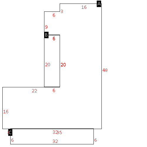 |
| Label |
Description |
Base SF |
Total SF |
| A |
SFR-1.0 STY |
1174.00 |
1174.00 |
| B |
PORCH-OPEN-FR |
120.00 |
.00 |
| C |
PORCH-OPEN-FR |
192.00 |
.00 |
|
|
(Building 2) - Sketch for Parcel ID: 3742405714.000
NOTE: Sketches are updated the first day of every month.
 |
| Label |
Description |
Base SF |
Total SF |
| A |
APT-DUPLEX/TRIPLEX |
1058.00 |
1058.00 |
| B |
PORCH-OPEN-FR |
42.00 |
.00 |
| C |
PORCH-OPEN-FR |
150.00 |
.00 |
|
|
(Building 3) - Sketch for Parcel ID: 3742405714.000
NOTE: Sketches are updated the first day of every month.
 |
| Label |
Description |
Base SF |
Total SF |
| A |
MFG-SINGLE WIDE |
756.00 |
756.00 |
| B |
SFR-ADDT FR |
195.00 |
195.00 |
| C |
CANOPY-ROOF ONLY |
100.00 |
.00 |
|
|
|
|
|
| Map Acres |
164.27 |
| Tax District Note |
12 - C/SW/EAST NASH FD |
| Present-Use Info |
RURAL HOMESITE |
| Zoning Code |
AR |
| Zoning Desc |
AGRICUL-RESID 40M SF |
|
| Total Improvements Valuation
|
*Total Improvements Full Market Value $
|
**Total Improvements Assessed Value
|
890,746
|
890,746
|
*
Note - Market Value effective Date equal January 1, 2024, date of County’s most recent General
Reappraisal
** Note - If Assessed Value not equal Market Value then variance
resulting from formal appeal procedure |
|
| Land
Value Detail (Effective Date January 1, 2024, date
of County’s most recent General Reappraisal) |
Land
Full Value (LFV) $
|
Land
Present-Use Value (PUV) $ **
|
Land
Total Assessed Value $
|
455,792
|
158,043
|
158,043
|
| **
Note: If PUV equal LMV then parcel has
not qualified for present use program |
|
| Land
Detail (Effective Date January 1, 2024, date of County’s
most recent General Reappraisal) |
Rate Type |
Rate Code |
Description |
Quantity |
AC |
5010 |
RURAL HOMESITE PAVED |
2.000 |
|
|
|
.000 |
AC |
5111 |
MKT OPEN LD PVD CLASS 1 |
48.500 |
LU |
5110 |
|
48.500 |
AC |
5211 |
MKT OPEN LD PVD CLASS 2 |
14.950 |
LU |
5210 |
|
14.950 |
AC |
5311 |
MKT OPEN LD PVD CLASS 3 |
21.320 |
LU |
5310 |
|
21.320 |
AC |
5411 |
MKT OPEN LD PVD CLASS 4 |
2.450 |
LU |
5410 |
|
2.450 |
AC |
6111 |
MKT WOODS PVD CLASS 1 |
39.670 |
LU |
6110 |
|
39.670 |
AC |
6211 |
MKT WOODS PVD CLASS 2 |
22.020 |
LU |
6210 |
|
22.020 |
AC |
6311 |
MKT WOODS PVD CLASS 3 |
10.410 |
LU |
6310 |
|
10.410 |
AC |
9600 |
WASTELAND |
2.950 |
|
|
|
.000 |
|
|
|
|
