| GRINE SUSAN SCULL |
| BAKER ELIZABETH SCULL |
|
| 5332 SURREY CIR |
|
| DALLAS , TX 75209 |
|
| Property
Location Address |
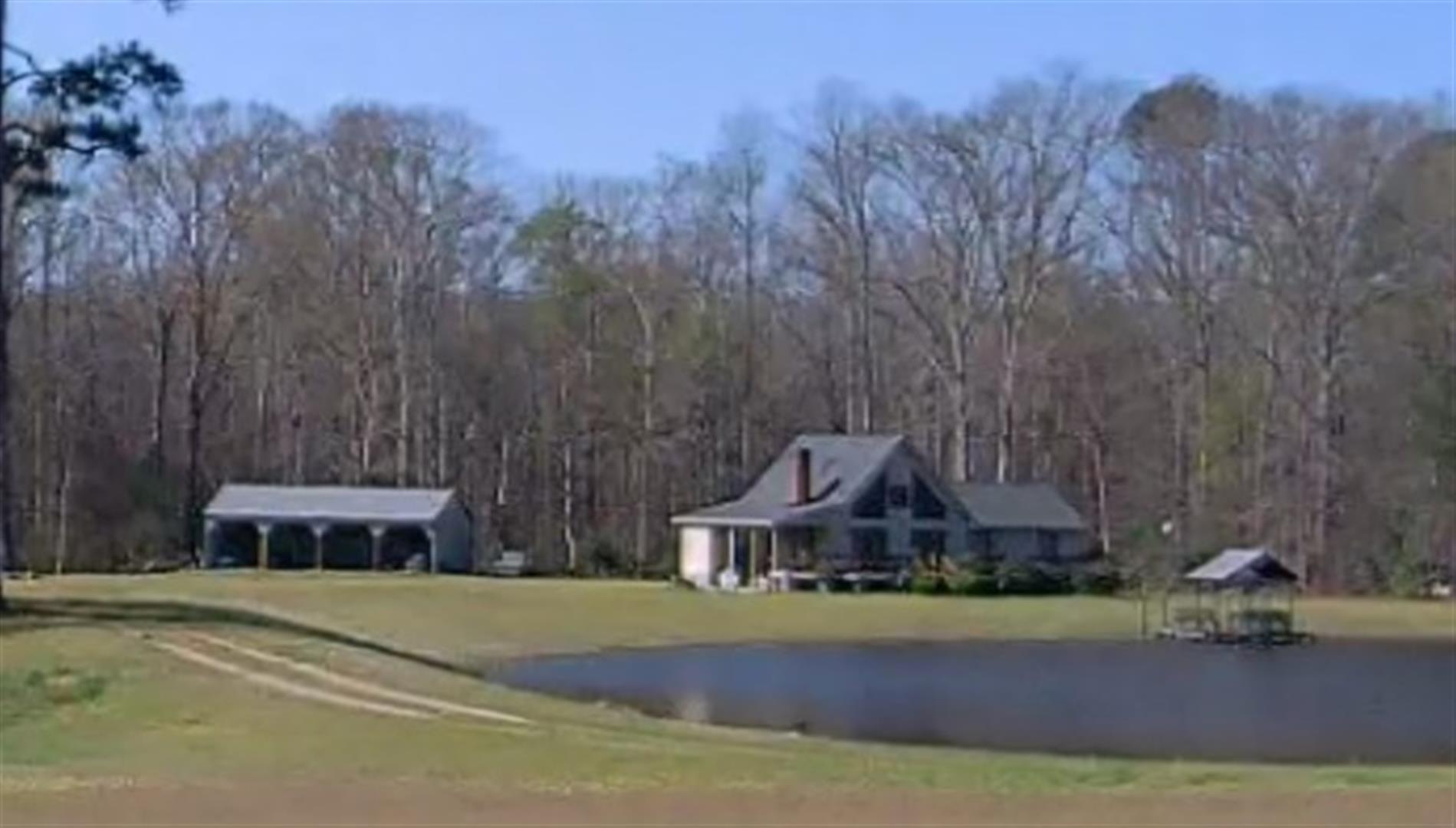
| 5629 THOMPSON CHAPEL CHURCH RD |
|
| Parcel
ID No. |
3705818273.000 |
| PIN |
3705 81 8273 000 |
| Owner ID |
1130313 |
| |
|
| Tax
District |
14 - C/SW/SILVER LAKE FD |
| |
| Land Use Code |
50 |
| Land Use Desc |
RURAL HOMESITE |
| |
|
| Neighborhood |
8311 - TAYLORS |
|
| Legal
Desc |
5629 THOMPSON CHAPEL CH R |
| |
BATTS&THOMPSON LD114.60AC |
| |
|
| Deed
Year Bk/Pg |
2023 - 3010 / 735 |
| Plat
Bk/Pg |
/ |
| |
Sales
Information |
| |
| Grantor |
JUDITH SCULL TRUST UNDER WILL |
| |
|
| Sold
Date |
2023-04-03 |
| Sold
Amount $ |
0 |
|
| |
| Market Value $ |
585,770
|
| |
|
Market
Value - Land and all permanent improvements,
if any, effective January 1, 2024, date
of County’s most recent General Reappraisal
|
|
| |
|
| Assessed Value $ |
434,089
|
| |
If
Assessed Value not equal Market Value then
subject parcel designated as a special
class -agricultural, horticultural, or
forestland and thereby eligible for taxation
on basis of Present-Use.
|
|
|
| Year
Built |
1998 |
| Built
Use/Style |
SFR-UPTO 1.5 STY |
| Grade |
C+10 / C+10 GRADE |
| * Percent
Complete |
100 |
| Heated
Area (S/F) |
2,013 |
| Fireplace
(Y/N) |
Y |
| Basement
(Y/N) |
N |
| ** Bedroom(s) |
2 |
| ** Bathroom(s) |
2 Full Bath(s) 0 Half Bath(s) |
| *** Multiple
Improvements |
002 |
*
Note - As of January 1
*
* Note - Bathroom(s), Bedroom(s), shown for description
only
* * * Note - If multiple improvements equal “MLT” then
parcel includes additional major improvements |
|
| Building
Sketch - NOTE: Sketches are updated the first day of every month. |
|
(Building 1) - Sketch for Parcel ID: 3705818273.000
NOTE: Sketches are updated the first day of every month.
 |
| Label |
Description |
Base SF |
Total SF |
| A |
SFR-1.0 STY |
1123.00 |
1123.00 |
| B |
PORCH-OPEN-FR |
192.00 |
.00 |
| C |
PORCH-OPEN-FR |
126.00 |
.00 |
|
|
(Building 2) - Sketch for Parcel ID: 3705818273.000
NOTE: Sketches are updated the first day of every month.
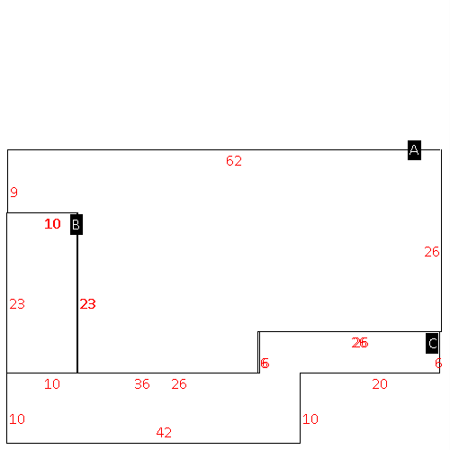 |
| Label |
Description |
Base SF |
Total SF |
| A |
SFR-1.5 STY |
1598.00 |
2013.00 |
| B |
PORCH-OPEN-MAS |
230.00 |
.00 |
| C |
DECK-WOOD |
576.00 |
.00 |
|
|
|
|
|
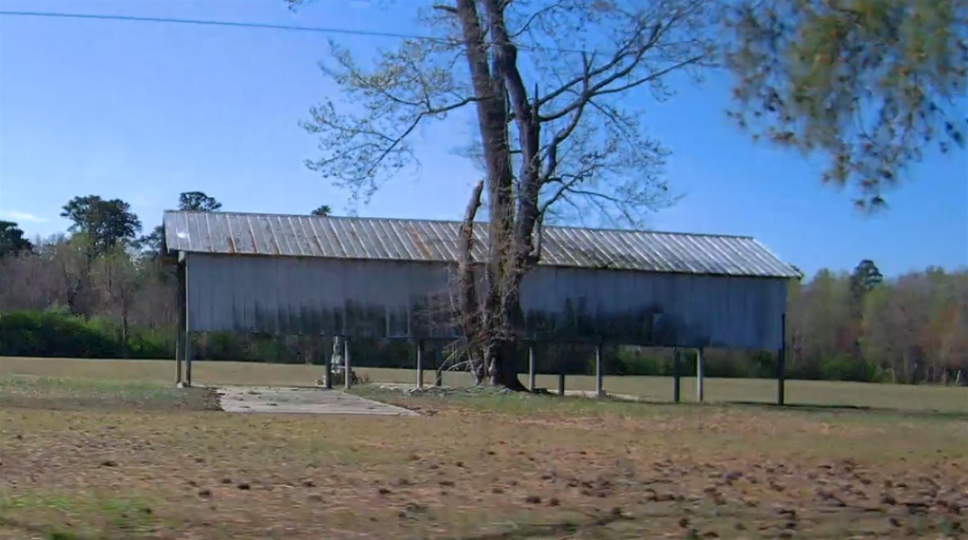
| Map Acres |
114.6 |
| Tax District Note |
14 - C/SW/SILVER LAKE FD |
| Present-Use Info |
RURAL HOMESITE |
| Zoning Code |
AR |
| Zoning Desc |
AGRICUL-RESID 40M SF |
|
| Total Improvements Valuation
|
*Total Improvements Full Market Value $
|
**Total Improvements Assessed Value
|
289,273
|
289,273
|
*
Note - Market Value effective Date equal January 1, 2024, date of County’s most recent General
Reappraisal
** Note - If Assessed Value not equal Market Value then variance
resulting from formal appeal procedure |
|
| Land
Value Detail (Effective Date January 1, 2024, date
of County’s most recent General Reappraisal) |
Land
Full Value (LFV) $
|
Land
Present-Use Value (PUV) $ **
|
Land
Total Assessed Value $
|
296,497
|
144,816
|
144,816
|
| **
Note: If PUV equal LMV then parcel has
not qualified for present use program |
|
| Land
Detail (Effective Date January 1, 2024, date of County’s
most recent General Reappraisal) |
Rate Type |
Rate Code |
Description |
Quantity |
AC |
5010 |
RURAL HOMESITE PAVED |
2.000 |
|
|
|
.000 |
AC |
5211 |
MKT OPEN LD PVD CLASS 2 |
73.040 |
LU |
5210 |
|
73.040 |
AC |
5411 |
MKT OPEN LD PVD CLASS 4 |
4.860 |
LU |
5410 |
|
4.860 |
AC |
6211 |
MKT WOODS PVD CLASS 2 |
31.200 |
LU |
6210 |
|
31.200 |
AC |
9600 |
WASTELAND |
3.500 |
|
|
|
.000 |
|
|
|
|