| WILLIAMS CALEB DESHAUN |
| WILLIAMS CALVIN D |
|
| 4659 EVANSDALE RD |
|
| WILSON , NC 27893-8054 |
|
| Property
Location Address |
|
| Parcel
ID No. |
3638899837.000 |
| PIN |
3638 89 9837 000 |
| Owner ID |
1117284 |
| |
|
| Tax
District |
17 - C/SW/MOYTON FD |
| |
| Land Use Code |
02 |
| Land Use Desc |
MANUFACTURED HOME (DW) |
| |
|
| Neighborhood |
8482 - EAGLES NEST SUBD |
|
| Legal
Desc |
5246 OLD STANTONSBURG RD |
| |
L3 EAGLE NEST 1.00LT |
| |
|
| Deed
Year Bk/Pg |
2019 - 2798 / 135 |
| Plat
Bk/Pg |
24 / 134 |
| |
Sales
Information |
| |
| Grantor |
BENT CREEK FARMS LLC |
| |
|
| Sold
Date |
2019-08-23 |
| Sold
Amount $ |
25,000 |
|
| |
| Market Value $ |
180,743
|
| |
|
Market
Value - Land and all permanent improvements,
if any, effective January 1, 2024, date
of County’s most recent General Reappraisal
|
|
| |
|
| Assessed Value $ |
180,743
|
| |
If
Assessed Value not equal Market Value then
subject parcel designated as a special
class -agricultural, horticultural, or
forestland and thereby eligible for taxation
on basis of Present-Use.
|
|
|
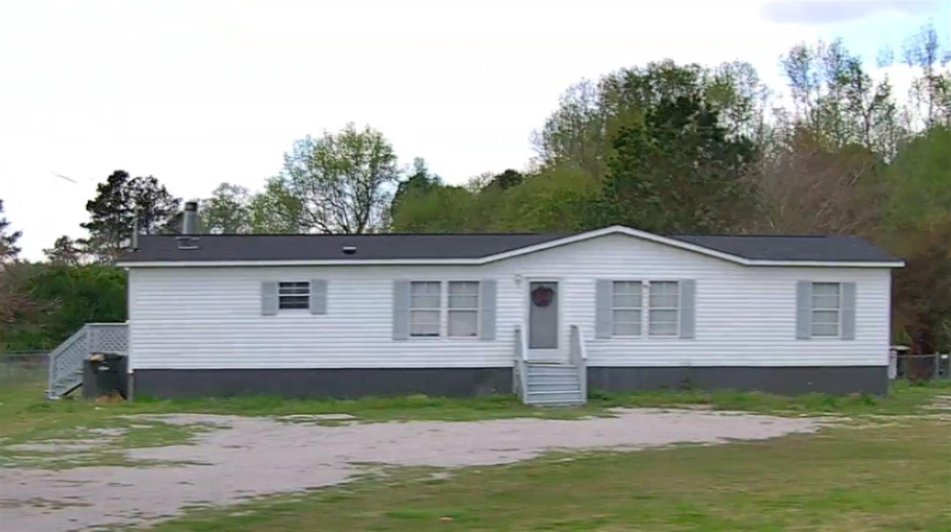
| Year
Built |
2015 |
| Built
Use/Style |
MH-DOUBLE WIDE |
| Grade |
C-05 / |
| * Percent
Complete |
100 |
| Heated
Area (S/F) |
1,508 |
| Fireplace
(Y/N) |
Y |
| Basement
(Y/N) |
N |
| ** Bedroom(s) |
3 |
| ** Bathroom(s) |
2 Full Bath(s) 0 Half Bath(s) |
| *** Multiple
Improvements |
001 |
*
Note - As of January 1
*
* Note - Bathroom(s), Bedroom(s), shown for description
only
* * * Note - If multiple improvements equal “MLT” then
parcel includes additional major improvements |
|
| Photo |
Photo 1
|
|
| Building
Sketch - NOTE: Sketches are updated the first day of every month. |
|
|
| Map Acres |
0.63 |
| Tax District Note |
17 - C/SW/MOYTON FD |
| Present-Use Info |
MANUFACTURED HOME (DW) |
| Zoning Code |
R20MH |
| Zoning Desc |
SGL FAMILY MFG 20M SF |
|
| Total Improvements Valuation
|
*Total Improvements Full Market Value $
|
**Total Improvements Assessed Value
|
160,743
|
160,743
|
*
Note - Market Value effective Date equal January 1, 2024, date of County’s most recent General
Reappraisal
** Note - If Assessed Value not equal Market Value then variance
resulting from formal appeal procedure |
|
| Land
Value Detail (Effective Date January 1, 2024, date
of County’s most recent General Reappraisal) |
Land
Full Value (LFV) $
|
Land
Present-Use Value (PUV) $ **
|
Land
Total Assessed Value $
|
20,000
|
20,000
|
20,000
|
| **
Note: If PUV equal LMV then parcel has
not qualified for present use program |
|
| Land
Detail (Effective Date January 1, 2024, date of County’s
most recent General Reappraisal) |
Rate Type |
Rate Code |
Description |
Quantity |
LT |
5010 |
RURAL HOMESITE PAVED |
1.000 |
|
|
|
.000 |
|
|
|
|
