|
|
| 6716 FLAT ROCK RD |
|
| SIMS , NC 27880-9608 |
|
| Property
Location Address |
|
| Parcel
ID No. |
2773813818.000 |
| PIN |
2773 81 3818 000 |
| Owner ID |
1110650 |
| |
|
| Tax
District |
22 - C/SW/SIMS FD |
| |
| Land Use Code |
50 |
| Land Use Desc |
RURAL HOMESITE |
| |
|
| Neighborhood |
8280 - SIMS_R-15 |
|
| Legal
Desc |
6716 FLAT ROCK RD |
| |
L3 PEELE EST DIV 1.42AC |
| |
|
| Deed
Year Bk/Pg |
2017 - 2719 / 565 |
| Plat
Bk/Pg |
19 / 24 |
| |
Sales
Information |
| |
| Grantor |
FARMER MARY ELLIOTT |
| |
|
| Sold
Date |
2017-10-20 |
| Sold
Amount $ |
170,000 |
|
| |
| Market Value $ |
292,547
|
| |
|
Market
Value - Land and all permanent improvements,
if any, effective January 1, 2024, date
of County’s most recent General Reappraisal
|
|
| |
|
| Assessed Value $ |
292,547
|
| |
If
Assessed Value not equal Market Value then
subject parcel designated as a special
class -agricultural, horticultural, or
forestland and thereby eligible for taxation
on basis of Present-Use.
|
|
|
| Year
Built |
1994 |
| Built
Use/Style |
SFR-1.0 STY |
| Grade |
C+10 / C+10 GRADE |
| * Percent
Complete |
100 |
| Heated
Area (S/F) |
1,761 |
| Fireplace
(Y/N) |
Y |
| Basement
(Y/N) |
N |
| ** Bedroom(s) |
3 |
| ** Bathroom(s) |
2 Full Bath(s) 1 Half Bath(s) |
| *** Multiple
Improvements |
001 |
*
Note - As of January 1
*
* Note - Bathroom(s), Bedroom(s), shown for description
only
* * * Note - If multiple improvements equal “MLT” then
parcel includes additional major improvements |
|
| Photo |
Photo 1
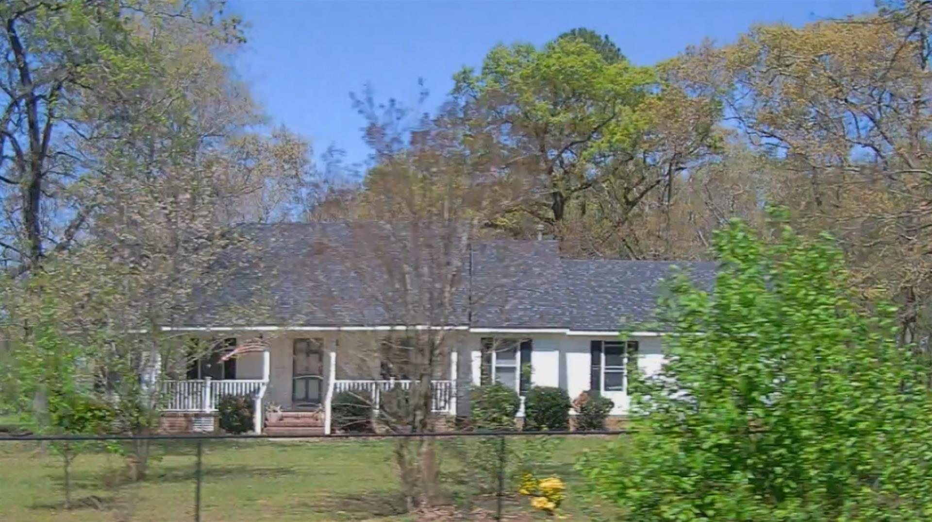
|
|
| Building
Sketch - NOTE: Sketches are updated the first day of every month. |
|
(Building 1) - Sketch for Parcel ID: 2773813818.000
NOTE: Sketches are updated the first day of every month.
 |
| Label |
Description |
Base SF |
Total SF |
| A |
SFR-1.0 STY |
1761.00 |
1761.00 |
| C |
PORCH-OPEN-MAS |
168.00 |
.00 |
| D |
GARAGE-ATT-FR |
650.00 |
.00 |
| E |
PATIO-CONC |
160.00 |
.00 |
|
|
|
|
|
| Map Acres |
1.42 |
| Tax District Note |
22 - C/SW/SIMS FD |
| Present-Use Info |
RURAL HOMESITE |
| Zoning Code |
R15 |
| Zoning Desc |
MULTI FAM RES DIST 15M SF |
|
| Total Improvements Valuation
|
*Total Improvements Full Market Value $
|
**Total Improvements Assessed Value
|
247,507
|
247,507
|
*
Note - Market Value effective Date equal January 1, 2024, date of County’s most recent General
Reappraisal
** Note - If Assessed Value not equal Market Value then variance
resulting from formal appeal procedure |
|
| Land
Value Detail (Effective Date January 1, 2024, date
of County’s most recent General Reappraisal) |
Land
Full Value (LFV) $
|
Land
Present-Use Value (PUV) $ **
|
Land
Total Assessed Value $
|
45,040
|
45,040
|
45,040
|
| **
Note: If PUV equal LMV then parcel has
not qualified for present use program |
|
| Land
Detail (Effective Date January 1, 2024, date of County’s
most recent General Reappraisal) |
Rate Type |
Rate Code |
Description |
Quantity |
AC |
5010 |
RURAL HOMESITE PAVED |
1.000 |
|
|
|
.000 |
AC |
0120 |
RURAL RESIDENTIAL ACREAGE |
.420 |
|
|
|
.000 |
|
|
|
|
