| CHASE HILL ROAD PROPERTIES LLC |
| |
|
| 120 BROADWAY |
STE 2120 |
| NEW YORK , NY 10271-2701 |
|
| Property
Location Address |
|
| Parcel
ID No. |
2792627982.000 |
| PIN |
2792 62 7982 000 |
| Owner ID |
1105431 |
| |
|
| Tax
District |
31 - C/CIWI-WILSON |
| |
| Land Use Code |
40 |
| Land Use Desc |
INDUSTRIAL |
| |
|
| Neighborhood |
8141 - I_95_I-2 |
|
| Legal
Desc |
4841 LAMM RD |
| |
L11A WLSN CORP PK 12.63AC |
| |
|
| Deed
Year Bk/Pg |
2015 - 2631 / 378 |
| Plat
Bk/Pg |
28 / 166 |
| |
Sales
Information |
| |
| Grantor |
LAMM ROAD PROPERTIES LLC |
| |
|
| Sold
Date |
2015-10-08 |
| Sold
Amount $ |
2,600,000 |
|
| |
| Market Value $ |
2,958,646
|
| |
|
Market
Value - Land and all permanent improvements,
if any, effective January 1, 2024, date
of County’s most recent General Reappraisal
|
|
| |
|
| Assessed Value $ |
2,958,646
|
| |
If
Assessed Value not equal Market Value then
subject parcel designated as a special
class -agricultural, horticultural, or
forestland and thereby eligible for taxation
on basis of Present-Use.
|
|
|
| Year
Built |
1999 |
| Built
Use/Style |
INDUSTRIAL |
| Grade |
C / C GRADE |
| * Percent
Complete |
100 |
| Heated
Area (S/F) |
129,409 |
| Fireplace
(Y/N) |
N |
| Basement
(Y/N) |
N |
| ** Bedroom(s) |
0 |
| ** Bathroom(s) |
0 Full Bath(s) 0 Half Bath(s) |
| *** Multiple
Improvements |
001 |
*
Note - As of January 1
*
* Note - Bathroom(s), Bedroom(s), shown for description
only
* * * Note - If multiple improvements equal “MLT” then
parcel includes additional major improvements |
|
| Photo |
Photo 1
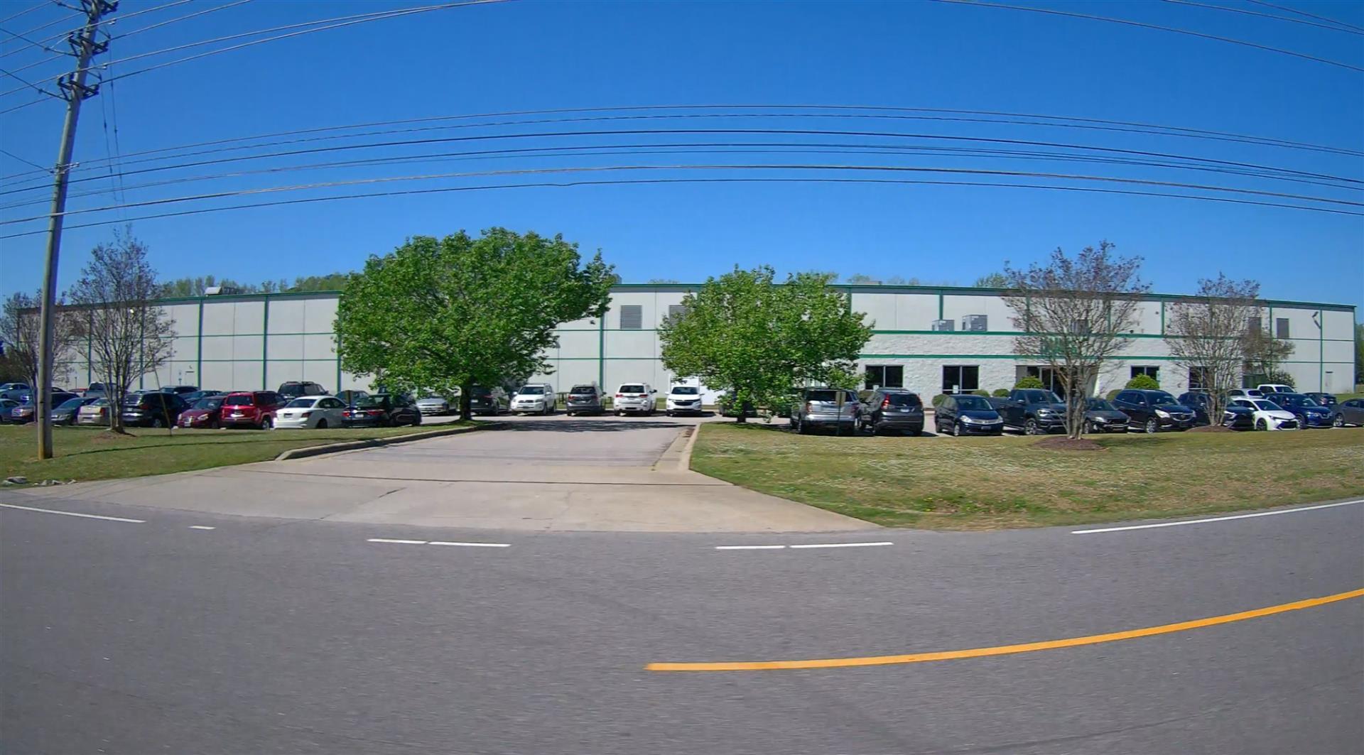
|
|
| Building
Sketch - NOTE: Sketches are updated the first day of every month. |
|
(Building 1) - Sketch for Parcel ID: 2792627982.000
NOTE: Sketches are updated the first day of every month.
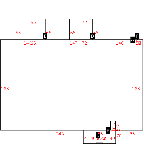 |
| Label |
Description |
Base SF |
Total SF |
| A |
INDUSTRIAL-LIGHT |
124934.00 |
124934.00 |
| B |
OFFICE BUILDING |
4475.00 |
4475.00 |
| C |
PORCH-OPEN-MAS |
60.00 |
.00 |
| D |
TRUCK WELL |
4680.00 |
.00 |
| E |
TRUCK WELL |
6175.00 |
.00 |
| F |
UTILITY STG-FR |
108.00 |
.00 |
|
|
|
|
|
| Map Acres |
12.63 |
| Tax District Note |
31 - C/CIWI-WILSON |
| Present-Use Info |
INDUSTRIAL |
| Zoning Code |
HI |
| Zoning Desc |
HEAVY INDUSTRIAL |
|
| Total Improvements Valuation
|
*Total Improvements Full Market Value $
|
**Total Improvements Assessed Value
|
2,676,964
|
2,676,964
|
*
Note - Market Value effective Date equal January 1, 2024, date of County’s most recent General
Reappraisal
** Note - If Assessed Value not equal Market Value then variance
resulting from formal appeal procedure |
|
| Land
Value Detail (Effective Date January 1, 2024, date
of County’s most recent General Reappraisal) |
Land
Full Value (LFV) $
|
Land
Present-Use Value (PUV) $ **
|
Land
Total Assessed Value $
|
281,682
|
281,682
|
281,682
|
| **
Note: If PUV equal LMV then parcel has
not qualified for present use program |
|
| Land
Detail (Effective Date January 1, 2024, date of County’s
most recent General Reappraisal) |
Rate Type |
Rate Code |
Description |
Quantity |
SF |
0600 |
INDUSTRIAL |
550162.000 |
|
|
|
.000 |
|
|
|
|
