| WEAVER JOSEPH P II |
| WEAVER RENEE T |
|
| 4603 JOWEAVER RD |
|
| WILSON , NC 27893-7958 |
|
| Property
Location Address |
|
| Parcel
ID No. |
3753110981.000 |
| PIN |
3753 11 0981 000 |
| Owner ID |
1068113 |
| |
|
| Tax
District |
12 - C/SW/EAST NASH FD |
| |
| Land Use Code |
50 |
| Land Use Desc |
RURAL HOMESITE |
| |
|
| Neighborhood |
8121 - GARDNERS |
|
| Legal
Desc |
WEAVER RD |
| |
49.64AC |
| |
|
| Deed
Year Bk/Pg |
2020 - 2696 / 607 |
| Plat
Bk/Pg |
/ |
| |
Sales
Information |
| |
| Grantor |
HENDRICKSON FARMS LLC |
| |
|
| Sold
Date |
2017-04-21 |
| Sold
Amount $ |
290,000 |
|
| |
| Market Value $ |
223,906
|
| |
|
Market
Value - Land and all permanent improvements,
if any, effective January 1, 2024, date
of County’s most recent General Reappraisal
|
|
| |
|
| Assessed Value $ |
104,909
|
| |
If
Assessed Value not equal Market Value then
subject parcel designated as a special
class -agricultural, horticultural, or
forestland and thereby eligible for taxation
on basis of Present-Use.
|
|
|
| Year
Built |
0 |
| Built
Use/Style |
|
| Grade |
/ |
| * Percent
Complete |
0 |
| Heated
Area (S/F) |
0 |
| Fireplace
(Y/N) |
N |
| Basement
(Y/N) |
N |
| ** Bedroom(s) |
0 |
| ** Bathroom(s) |
0 Full Bath(s) 0 Half Bath(s) |
| *** Multiple
Improvements |
000 |
*
Note - As of January 1
*
* Note - Bathroom(s), Bedroom(s), shown for description
only
* * * Note - If multiple improvements equal “MLT” then
parcel includes additional major improvements |
|
| Photo |
Photo 1
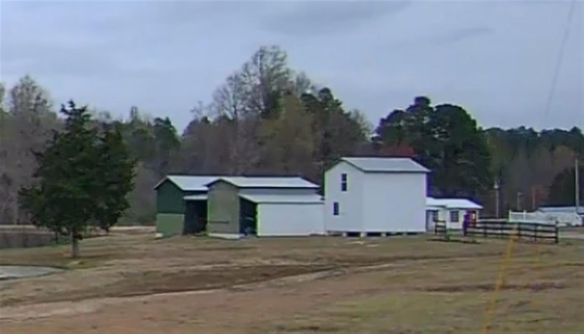
|
|
| Building
Sketch - NOTE: Sketches are updated the first day of every month. |
|
|
| Map Acres |
49.64 |
| Tax District Note |
12 - C/SW/EAST NASH FD |
| Present-Use Info |
RURAL HOMESITE |
| Zoning Code |
AR |
| Zoning Desc |
AGRICUL-RESID 40M SF |
|
| Total Improvements Valuation
|
*Total Improvements Full Market Value $
|
**Total Improvements Assessed Value
|
32,099
|
32,099
|
*
Note - Market Value effective Date equal January 1, 2024, date of County’s most recent General
Reappraisal
** Note - If Assessed Value not equal Market Value then variance
resulting from formal appeal procedure |
|
| Land
Value Detail (Effective Date January 1, 2024, date
of County’s most recent General Reappraisal) |
Land
Full Value (LFV) $
|
Land
Present-Use Value (PUV) $ **
|
Land
Total Assessed Value $
|
191,807
|
72,810
|
72,810
|
| **
Note: If PUV equal LMV then parcel has
not qualified for present use program |
|
| Land
Detail (Effective Date January 1, 2024, date of County’s
most recent General Reappraisal) |
Rate Type |
Rate Code |
Description |
Quantity |
AC |
5010 |
RURAL HOMESITE PAVED |
1.000 |
|
|
|
.000 |
AC |
0121 |
RESIDUAL ACREAGE PAVED |
.600 |
|
|
|
.000 |
AC |
5111 |
MKT OPEN LD PVD CLASS 1 |
34.860 |
LU |
5110 |
|
34.860 |
AC |
5411 |
MKT OPEN LD PVD CLASS 4 |
.810 |
LU |
5410 |
|
.810 |
AC |
6211 |
MKT WOODS PVD CLASS 2 |
2.210 |
LU |
6210 |
|
2.210 |
AC |
6311 |
MKT WOODS PVD CLASS 3 |
8.110 |
LU |
6310 |
|
8.110 |
AC |
9500 |
POND/LAKE |
2.050 |
|
|
|
.000 |
|
|
|
|
