| FULGHUM WILLIE JOE |
| FULGHUM DEE JACKSON |
|
| 7659 FULGHUM RD |
|
| SIMS , NC 27880 |
|
| Property
Location Address |
|
| Parcel
ID No. |
2761448724.000 |
| PIN |
2761 44 8724 000 |
| Owner ID |
1049988 |
| |
|
| Tax
District |
19 - C/SW/ROCK RIDGE FD |
| |
| Land Use Code |
50 |
| Land Use Desc |
RURAL HOMESITE |
| |
|
| Neighborhood |
8219 - OLD_FIELDS |
|
| Legal
Desc |
7659 FULGHUM RD |
| |
TR-1 45.60AC |
| |
|
| Deed
Year Bk/Pg |
2016 - 2645 / 546 |
| Plat
Bk/Pg |
37 / 4 |
| |
Sales
Information |
| |
| Grantor |
FULGHUM R KEITH |
| |
FULGHUM WILLIE JOE |
| Sold
Date |
2016-02-18 |
| Sold
Amount $ |
100,000 |
|
| |
| Market Value $ |
357,507
|
| |
|
Market
Value - Land and all permanent improvements,
if any, effective January 1, 2024, date
of County’s most recent General Reappraisal
|
|
| |
|
| Assessed Value $ |
288,846
|
| |
If
Assessed Value not equal Market Value then
subject parcel designated as a special
class -agricultural, horticultural, or
forestland and thereby eligible for taxation
on basis of Present-Use.
|
|
|
| Year
Built |
1900 |
| Built
Use/Style |
SFR-1.0 STY |
| Grade |
C+05 / C+05 GRADE |
| * Percent
Complete |
100 |
| Heated
Area (S/F) |
2,398 |
| Fireplace
(Y/N) |
Y |
| Basement
(Y/N) |
N |
| ** Bedroom(s) |
3 |
| ** Bathroom(s) |
2 Full Bath(s) 0 Half Bath(s) |
| *** Multiple
Improvements |
001 |
*
Note - As of January 1
*
* Note - Bathroom(s), Bedroom(s), shown for description
only
* * * Note - If multiple improvements equal “MLT” then
parcel includes additional major improvements |
|
| Photo |
Photo 1
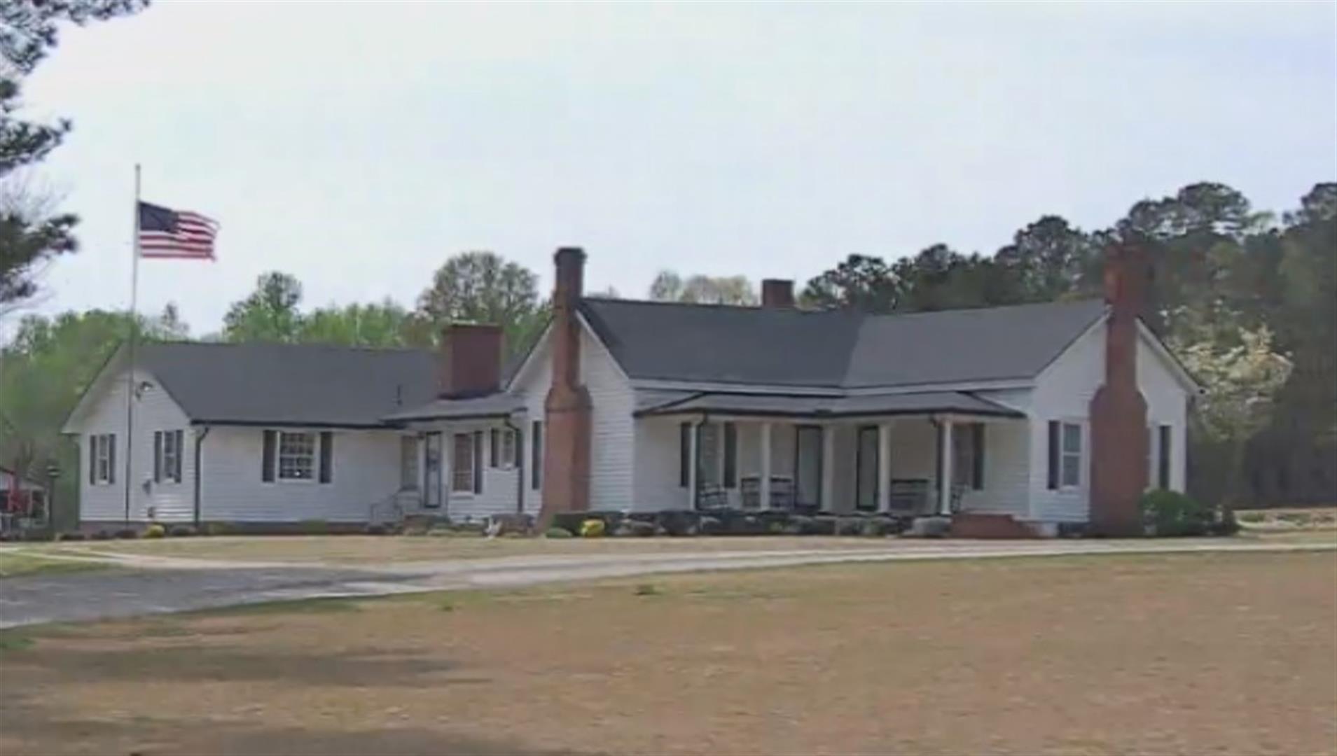
|
|
| Building
Sketch - NOTE: Sketches are updated the first day of every month. |
|
(Building 1) - Sketch for Parcel ID: 2761448724.000
NOTE: Sketches are updated the first day of every month.
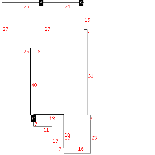 |
| Label |
Description |
Base SF |
Total SF |
| A |
SFR-1.0 STY |
2398.00 |
2398.00 |
| B |
GARAGE-ATT-FR |
675.00 |
.00 |
| C |
PORCH-OPEN-MAS |
217.00 |
.00 |
|
|
|
|
|
| Map Acres |
45.6 |
| Tax District Note |
19 - C/SW/ROCK RIDGE FD |
| Present-Use Info |
RURAL HOMESITE |
| Zoning Code |
AR |
| Zoning Desc |
AGRICUL-RESID 40M SF |
|
| Total Improvements Valuation
|
*Total Improvements Full Market Value $
|
**Total Improvements Assessed Value
|
225,197
|
225,197
|
*
Note - Market Value effective Date equal January 1, 2024, date of County’s most recent General
Reappraisal
** Note - If Assessed Value not equal Market Value then variance
resulting from formal appeal procedure |
|
| Land
Value Detail (Effective Date January 1, 2024, date
of County’s most recent General Reappraisal) |
Land
Full Value (LFV) $
|
Land
Present-Use Value (PUV) $ **
|
Land
Total Assessed Value $
|
132,310
|
63,649
|
63,649
|
| **
Note: If PUV equal LMV then parcel has
not qualified for present use program |
|
| Land
Detail (Effective Date January 1, 2024, date of County’s
most recent General Reappraisal) |
Rate Type |
Rate Code |
Description |
Quantity |
AC |
5010 |
RURAL HOMESITE PAVED |
1.000 |
|
|
|
.000 |
AC |
5111 |
MKT OPEN LD PVD CLASS 1 |
8.280 |
LU |
5120 |
|
8.280 |
AC |
5211 |
MKT OPEN LD PVD CLASS 2 |
15.970 |
LU |
5220 |
|
15.970 |
AC |
6211 |
MKT WOODS PVD CLASS 2 |
9.670 |
LU |
6220 |
|
9.670 |
AC |
6311 |
MKT WOODS PVD CLASS 3 |
10.680 |
LU |
6320 |
|
10.680 |
|
|
|
|
