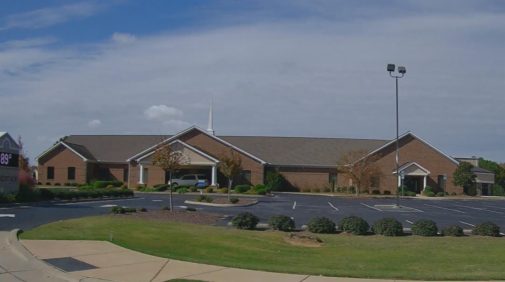
| TABERNACLE BAPTIST CHURCH |
| |
|
| 1815 AIRPORT BLVD W |
|
| WILSON , NC 27893 |
|
| Property
Location Address |
|
| Parcel
ID No. |
3702259467.000 |
| PIN |
3702 25 9467 000 |
| Owner ID |
10489440 |
| |
|
| Tax
District |
31 - C/CIWI-WILSON |
| |
| Land Use Code |
71 |
| Land Use Desc |
CHURCHES |
| |
|
| Neighborhood |
8219 - OLD_FIELDS |
|
| Legal
Desc |
1815 AIRPORT BLVD W |
| |
L41 13.00AC |
| |
|
| Deed
Year Bk/Pg |
2011 - 2468 / 679 |
| Plat
Bk/Pg |
38 / 238 |
| |
Sales
Information |
| |
| Grantor |
|
| |
|
| Sold
Date |
0--0 |
| Sold
Amount $ |
0 |
|
| |
| Market Value $ |
5,592,242
|
| |
|
Market
Value - Land and all permanent improvements,
if any, effective January 1, 2024, date
of County’s most recent General Reappraisal
|
|
| |
|
| Assessed Value $ |
5,592,242
|
| |
If
Assessed Value not equal Market Value then
subject parcel designated as a special
class -agricultural, horticultural, or
forestland and thereby eligible for taxation
on basis of Present-Use.
|
|
|
| Year
Built |
2012 |
| Built
Use/Style |
CHURCH |
| Grade |
C+05 / C+05 GRADE |
| * Percent
Complete |
100 |
| Heated
Area (S/F) |
35,905 |
| Fireplace
(Y/N) |
N |
| Basement
(Y/N) |
N |
| ** Bedroom(s) |
0 |
| ** Bathroom(s) |
0 Full Bath(s) 0 Half Bath(s) |
| *** Multiple
Improvements |
001 |
*
Note - As of January 1
*
* Note - Bathroom(s), Bedroom(s), shown for description
only
* * * Note - If multiple improvements equal “MLT” then
parcel includes additional major improvements |
|
| Photo |
Photo 1
|
|
| Building
Sketch - NOTE: Sketches are updated the first day of every month. |
|
(Building 1) - Sketch for Parcel ID: 3702259467.000
NOTE: Sketches are updated the first day of every month.
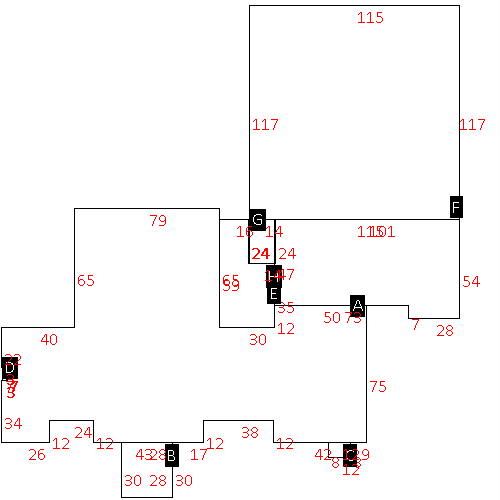 |
| Label |
Description |
Base SF |
Total SF |
| A |
CHURCH |
17507.00 |
17507.00 |
| B |
PORCH-OPEN-MAS |
840.00 |
.00 |
| C |
PORCH-OPEN-MAS |
96.00 |
.00 |
| D |
PORCH-OPEN-MAS |
21.00 |
.00 |
| E |
CHURCH |
4943.00 |
4943.00 |
| F |
CHURCH |
13455.00 |
13455.00 |
| G |
PORCH-OPEN-SLAB |
336.00 |
.00 |
| H |
PATIO-CONC |
1434.00 |
.00 |
|
|
|
|
|
| Map Acres |
13 |
| Tax District Note |
31 - C/CIWI-WILSON |
| Present-Use Info |
CHURCHES |
| Zoning Code |
NC |
| Zoning Desc |
NBRHD COMMERCIAL |
|
| Total Improvements Valuation
|
*Total Improvements Full Market Value $
|
**Total Improvements Assessed Value
|
5,351,474
|
5,351,474
|
*
Note - Market Value effective Date equal January 1, 2024, date of County’s most recent General
Reappraisal
** Note - If Assessed Value not equal Market Value then variance
resulting from formal appeal procedure |
|
| Land
Value Detail (Effective Date January 1, 2024, date
of County’s most recent General Reappraisal) |
Land
Full Value (LFV) $
|
Land
Present-Use Value (PUV) $ **
|
Land
Total Assessed Value $
|
240,768
|
240,768
|
240,768
|
| **
Note: If PUV equal LMV then parcel has
not qualified for present use program |
|
| Land
Detail (Effective Date January 1, 2024, date of County’s
most recent General Reappraisal) |
Rate Type |
Rate Code |
Description |
Quantity |
AC |
0400 |
OFFICE |
3.860 |
|
|
|
.000 |
AC |
7100 |
CHURCHES |
4.400 |
|
|
|
.000 |
AC |
0121 |
RESIDUAL ACREAGE PAVED |
4.740 |
|
|
|
.000 |
|
|
|
|
