| VALDOVINOS NORA RODRIGUEZ |
| |
|
| 8123 SPRING HILL CHURCH RD |
|
| LUCAMA , NC 27851-9327 |
|
| Property
Location Address |
|
| Parcel
ID No. |
2699174401.000 |
| PIN |
2699 17 4401 000 |
| Owner ID |
1019397 |
| |
|
| Tax
District |
15 - C/SW/CROSSROADS FD |
| |
| Land Use Code |
03 |
| Land Use Desc |
MANUFACTURED HOME (SW) |
| |
|
| Neighborhood |
8081 - CROSSROADS_TWP |
|
| Legal
Desc |
5659 SCOTT CHURCH RD |
| |
.71AC |
| |
|
| Deed
Year Bk/Pg |
2016 - 2644 / 177 |
| Plat
Bk/Pg |
/ |
| |
Sales
Information |
| |
| Grantor |
ALLEN SAMANTHA GAIL |
| |
LITTLE ADAM |
| Sold
Date |
2016-02-03 |
| Sold
Amount $ |
24,000 |
|
| |
| Market Value $ |
20,103
|
| |
|
Market
Value - Land and all permanent improvements,
if any, effective January 1, 2024, date
of County’s most recent General Reappraisal
|
|
| |
|
| Assessed Value $ |
20,103
|
| |
If
Assessed Value not equal Market Value then
subject parcel designated as a special
class -agricultural, horticultural, or
forestland and thereby eligible for taxation
on basis of Present-Use.
|
|
|
| Year
Built |
0 |
| Built
Use/Style |
|
| Grade |
/ |
| * Percent
Complete |
0 |
| Heated
Area (S/F) |
0 |
| Fireplace
(Y/N) |
N |
| Basement
(Y/N) |
N |
| ** Bedroom(s) |
0 |
| ** Bathroom(s) |
0 Full Bath(s) 0 Half Bath(s) |
| *** Multiple
Improvements |
000 |
*
Note - As of January 1
*
* Note - Bathroom(s), Bedroom(s), shown for description
only
* * * Note - If multiple improvements equal “MLT” then
parcel includes additional major improvements |
|
| Photo |
Photo 1
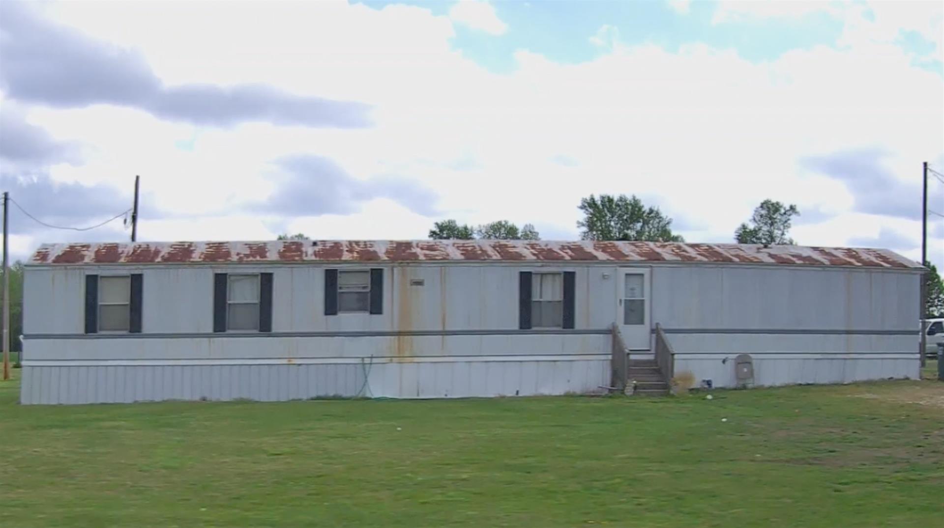
|
|
| Building
Sketch - NOTE: Sketches are updated the first day of every month. |
|
|
| Map Acres |
0.71 |
| Tax District Note |
15 - C/SW/CROSSROADS FD |
| Present-Use Info |
MANUFACTURED HOME (SW) |
| Zoning Code |
AR |
| Zoning Desc |
AGRICUL-RESID 40M SF |
|
| Total Improvements Valuation
|
*Total Improvements Full Market Value $
|
**Total Improvements Assessed Value
|
2,069
|
2,069
|
*
Note - Market Value effective Date equal January 1, 2024, date of County’s most recent General
Reappraisal
** Note - If Assessed Value not equal Market Value then variance
resulting from formal appeal procedure |
|
| Land
Value Detail (Effective Date January 1, 2024, date
of County’s most recent General Reappraisal) |
Land
Full Value (LFV) $
|
Land
Present-Use Value (PUV) $ **
|
Land
Total Assessed Value $
|
18,034
|
18,034
|
18,034
|
| **
Note: If PUV equal LMV then parcel has
not qualified for present use program |
|
| Land
Detail (Effective Date January 1, 2024, date of County’s
most recent General Reappraisal) |
Rate Type |
Rate Code |
Description |
Quantity |
AC |
5010 |
RURAL HOMESITE PAVED |
.710 |
|
|
|
.000 |
|
|
|
|
