|
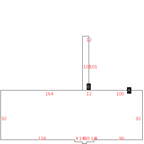
(Building 1) - Sketch for Parcel ID: 3733536060.000
NOTE: Sketches are updated the first day of every month.
 |
| Label |
Description |
Base SF |
Total SF |
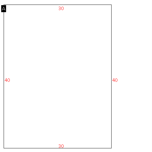
| A |
OFFICE BUILDING |
24456.00 |
24456.00 |
| B |
CANOPY-ECONOMY |
1212.00 |
.00 |
|
|
(Building 2) - Sketch for Parcel ID: 3733536060.000
NOTE: Sketches are updated the first day of every month.
 |
| Label |
Description |
Base SF |
Total SF |
| A |
WHSE |
460965.00 |
460965.00 |
| B |
UNCOV LOAD PLATFORM-AVG |
6970.00 |
.00 |
| C |
OFFICE BUILDING |
6212.00 |
6212.00 |
| D |
TRUCK WELL |
30000.00 |
.00 |
|
|
(Building 3) - Sketch for Parcel ID: 3733536060.000
NOTE: Sketches are updated the first day of every month.
 |
| Label |
Description |
Base SF |
Total SF |
| A |
WHSE |
15150.00 |
15150.00 |
|
|
(Building 4) - Sketch for Parcel ID: 3733536060.000
NOTE: Sketches are updated the first day of every month.
 |
| Label |
Description |
Base SF |
Total SF |
| A |
WHSE |
2356.00 |
2356.00 |
|
|
(Building 5) - Sketch for Parcel ID: 3733536060.000
NOTE: Sketches are updated the first day of every month.
 |
| Label |
Description |
Base SF |
Total SF |
| A |
WHSE |
1431.00 |
1431.00 |
|
|
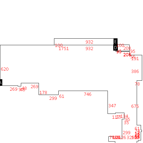
(Building 6) - Sketch for Parcel ID: 3733536060.000
NOTE: Sketches are updated the first day of every month.
 |
| Label |
Description |
Base SF |
Total SF |
| A |
INDUSTRIAL-HEAVY |
1676709.00 |
1676709.00 |
| D |
INDUSTRIAL-HEAVY |
19855.00 |
19855.00 |
| E |
INDUSTRIAL-HEAVY |
93400.00 |
93400.00 |
|
|
(Building 7) - Sketch for Parcel ID: 3733536060.000
NOTE: Sketches are updated the first day of every month.
 |
| Label |
Description |
Base SF |
Total SF |
|
|
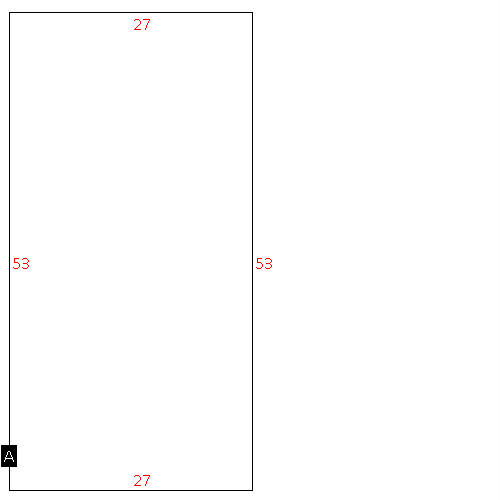
(Building 8) - Sketch for Parcel ID: 3733536060.000
NOTE: Sketches are updated the first day of every month.
 |
| Label |
Description |
Base SF |
Total SF |
| A |
OFFICE BUILDING |
2664.00 |
2664.00 |
|
|
(Building 9) - Sketch for Parcel ID: 3733536060.000
NOTE: Sketches are updated the first day of every month.
 |
| Label |
Description |
Base SF |
Total SF |
| A |
WHSE |
5000.00 |
5000.00 |
|
|
(Building 10) - Sketch for Parcel ID: 3733536060.000
NOTE: Sketches are updated the first day of every month.
 |
| Label |
Description |
Base SF |
Total SF |
| A |
OFFICE BUILDING |
4148.00 |
4148.00 |
|
|
(Building 11) - Sketch for Parcel ID: 3733536060.000
NOTE: Sketches are updated the first day of every month.
 |
| Label |
Description |
Base SF |
Total SF |
| A |
OFFICE BUILDING |
3168.00 |
3168.00 |
|
|
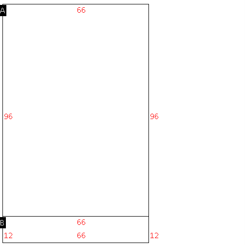
(Building 12) - Sketch for Parcel ID: 3733536060.000
NOTE: Sketches are updated the first day of every month.
 |
| Label |
Description |
Base SF |
Total SF |
| A |
WHSE |
1200.00 |
1200.00 |
|
|
(Building 13) - Sketch for Parcel ID: 3733536060.000
NOTE: Sketches are updated the first day of every month.
 |
| Label |
Description |
Base SF |
Total SF |
| A |
WHSE |
5000.00 |
5000.00 |
|
|
(Building 14) - Sketch for Parcel ID: 3733536060.000
NOTE: Sketches are updated the first day of every month.
 |
| Label |
Description |
Base SF |
Total SF |
| A |
WHSE |
1225.00 |
1225.00 |
|
|
(Building 15) - Sketch for Parcel ID: 3733536060.000
NOTE: Sketches are updated the first day of every month.
 |
| Label |
Description |
Base SF |
Total SF |
| A |
WHSE |
6336.00 |
6336.00 |
| B |
CARPORT |
792.00 |
.00 |
|
|
(Building 16) - Sketch for Parcel ID: 3733536060.000
NOTE: Sketches are updated the first day of every month.
 |
| Label |
Description |
Base SF |
Total SF |
| A |
WHSE |
6336.00 |
6336.00 |
|
|
(Building 17) - Sketch for Parcel ID: 3733536060.000
NOTE: Sketches are updated the first day of every month.
 |
| Label |
Description |
Base SF |
Total SF |
| A |
WHSE |
1200.00 |
1200.00 |
|
|
|