|
|
| 3313 US HIGHWAY 264 ALT E |
|
| WILSON , NC 27893-7661 |
|
| Property
Location Address |
|
| Parcel
ID No. |
3731709459.000 |
| PIN |
3731 70 9459 000 |
| Owner ID |
69936970 |
| |
|
| Tax
District |
12 - C/SW/EAST NASH FD |
| |
| Land Use Code |
01 |
| Land Use Desc |
SINGLE FAMILY RESIDENTIAL |
| |
|
| Neighborhood |
8187 - MARTIN_LUTHER_KING_JR_PRK |
|
| Legal
Desc |
3313 M L KING JR PKWY E |
| |
141.10AC |
| |
|
| Deed
Year Bk/Pg |
2018 - 2522 / 339 |
| Plat
Bk/Pg |
/ |
| |
Sales
Information |
| |
| Grantor |
BEAMAN JOYCE PROCTOR (LER) |
| |
BEAMAN BOBBY DAVID |
| Sold
Date |
2018-10-26 |
| Sold
Amount $ |
0 |
|
| |
| Market Value $ |
555,513
|
| |
|
Market
Value - Land and all permanent improvements,
if any, effective January 1, 2024, date
of County’s most recent General Reappraisal
|
|
| |
|
| Assessed Value $ |
288,391
|
| |
If
Assessed Value not equal Market Value then
subject parcel designated as a special
class -agricultural, horticultural, or
forestland and thereby eligible for taxation
on basis of Present-Use.
|
|
|
| Year
Built |
1922 |
| Built
Use/Style |
SFR-UPTO 1.5 STY |
| Grade |
C-05 / C-05 GRADE |
| * Percent
Complete |
100 |
| Heated
Area (S/F) |
1,900 |
| Fireplace
(Y/N) |
N |
| Basement
(Y/N) |
N |
| ** Bedroom(s) |
4 |
| ** Bathroom(s) |
1 Full Bath(s) 0 Half Bath(s) |
| *** Multiple
Improvements |
001 |
*
Note - As of January 1
*
* Note - Bathroom(s), Bedroom(s), shown for description
only
* * * Note - If multiple improvements equal “MLT” then
parcel includes additional major improvements |
|
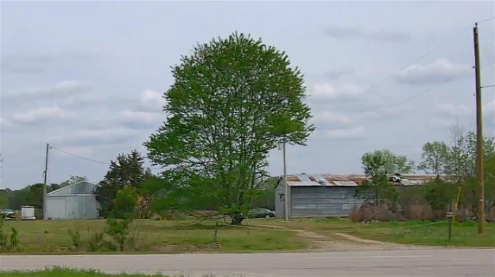
| Photo |
Photo 1
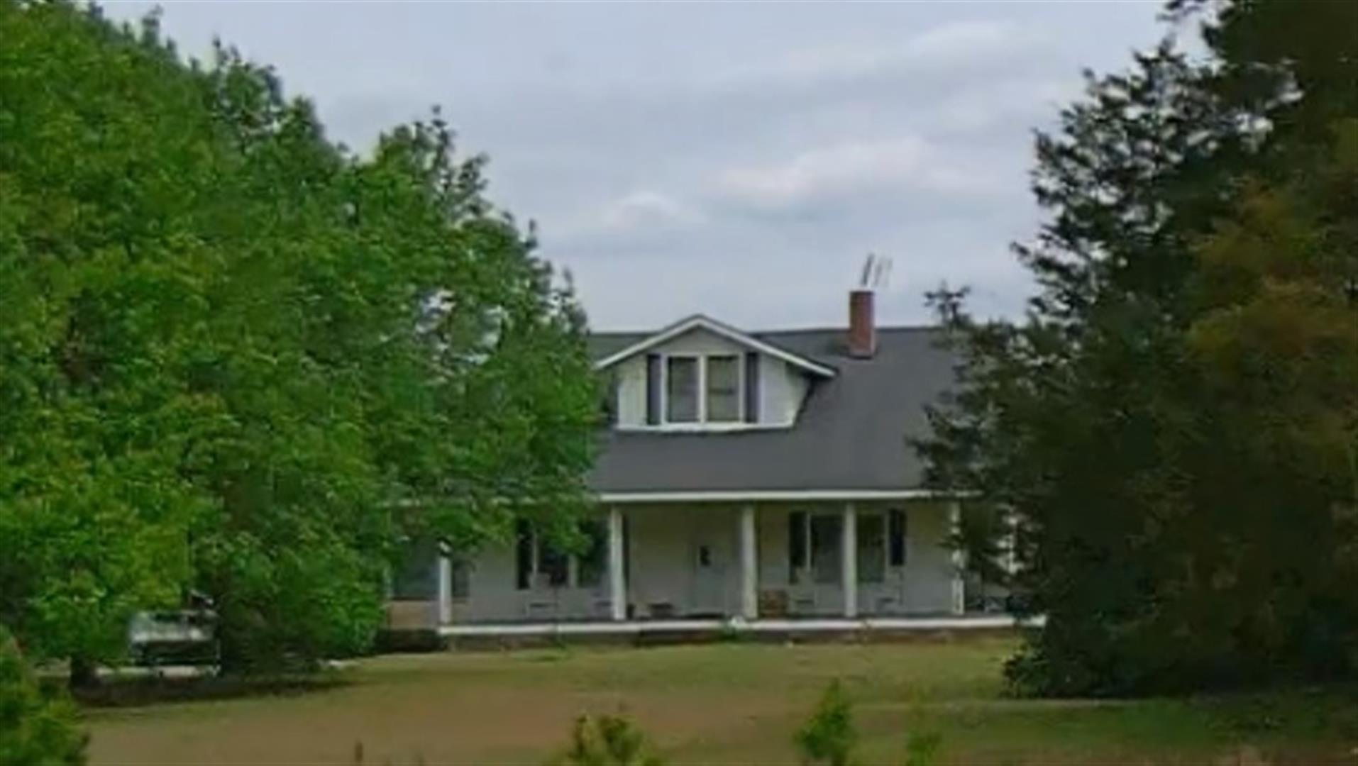 Photo 2
|
|
| Building
Sketch - NOTE: Sketches are updated the first day of every month. |
|
(Building 1) - Sketch for Parcel ID: 3731709459.000
NOTE: Sketches are updated the first day of every month.
 |
| Label |
Description |
Base SF |
Total SF |
| A |
SFR-1.5 STY |
1900.00 |
1900.00 |
| B |
CARPORT |
200.00 |
.00 |
| C |
PORCH-OPEN-FR |
507.00 |
.00 |
|
|
|
|
|
| Map Acres |
141.1 |
| Tax District Note |
12 - C/SW/EAST NASH FD |
| Present-Use Info |
SINGLE FAMILY RESIDENTIAL |
| Zoning Code |
SR4 |
| Zoning Desc |
SUB RES LOW DENSITY |
|
| Total Improvements Valuation
|
*Total Improvements Full Market Value $
|
**Total Improvements Assessed Value
|
111,093
|
111,093
|
*
Note - Market Value effective Date equal January 1, 2024, date of County’s most recent General
Reappraisal
** Note - If Assessed Value not equal Market Value then variance
resulting from formal appeal procedure |
|
| Land
Value Detail (Effective Date January 1, 2024, date
of County’s most recent General Reappraisal) |
Land
Full Value (LFV) $
|
Land
Present-Use Value (PUV) $ **
|
Land
Total Assessed Value $
|
444,420
|
177,298
|
177,298
|
| **
Note: If PUV equal LMV then parcel has
not qualified for present use program |
|
| Land
Detail (Effective Date January 1, 2024, date of County’s
most recent General Reappraisal) |
Rate Type |
Rate Code |
Description |
Quantity |
AC |
5010 |
RURAL HOMESITE PAVED |
3.000 |
|
|
|
.000 |
AC |
0120 |
RURAL RESIDENTIAL ACREAGE |
38.700 |
LU |
5110 |
|
38.700 |
AC |
0120 |
RURAL RESIDENTIAL ACREAGE |
5.800 |
LU |
5210 |
|
5.800 |
AC |
0120 |
RURAL RESIDENTIAL ACREAGE |
3.400 |
LU |
5310 |
|
3.400 |
AC |
0120 |
RURAL RESIDENTIAL ACREAGE |
7.850 |
LU |
6210 |
|
7.850 |
AC |
5111 |
MKT OPEN LD PVD CLASS 1 |
27.450 |
LU |
5110 |
|
27.450 |
AC |
5211 |
MKT OPEN LD PVD CLASS 2 |
2.700 |
LU |
5210 |
|
2.700 |
AC |
6111 |
MKT WOODS PVD CLASS 1 |
14.200 |
LU |
6110 |
|
14.200 |
AC |
6211 |
MKT WOODS PVD CLASS 2 |
16.150 |
LU |
6210 |
|
16.150 |
AC |
6311 |
MKT WOODS PVD CLASS 3 |
8.250 |
LU |
6310 |
|
8.250 |
AC |
5111 |
MKT OPEN LD PVD CLASS 1 |
11.000 |
LU |
5110 |
|
11.000 |
AC |
5211 |
MKT OPEN LD PVD CLASS 2 |
1.300 |
LU |
5210 |
|
1.300 |
AC |
6211 |
MKT WOODS PVD CLASS 2 |
1.300 |
LU |
6210 |
|
1.300 |
|
|
|
|
