| BASS WILLIAM SILAS JR (HEIRS) |
| |
|
| 5370 BASS RD |
|
| LUCAMA , NC 27851-9256 |
|
| Property
Location Address |
|
| Parcel
ID No. |
2699841798.000 |
| PIN |
2699 84 1798 000 |
| Owner ID |
31400111 |
| |
|
| Tax
District |
15 - C/SW/CROSSROADS FD |
| |
| Land Use Code |
10 |
| Land Use Desc |
COMMERICAL |
| |
|
| Neighborhood |
8183 - LUCAMA_RA-20 |
|
| Legal
Desc |
BASS RD |
| |
TR-4 W T BASS LD 19.32AC |
| |
|
| Deed
Year Bk/Pg |
2019 - 1419 / 480 |
| Plat
Bk/Pg |
3 / 88 |
| |
Sales
Information |
| |
| Grantor |
|
| |
|
| Sold
Date |
0--0 |
| Sold
Amount $ |
0 |
|
| |
| Market Value $ |
450,848
|
| |
|
Market
Value - Land and all permanent improvements,
if any, effective January 1, 2024, date
of County’s most recent General Reappraisal
|
|
| |
|
| Assessed Value $ |
425,248
|
| |
If
Assessed Value not equal Market Value then
subject parcel designated as a special
class -agricultural, horticultural, or
forestland and thereby eligible for taxation
on basis of Present-Use.
|
|
|
| Year
Built |
1997 |
| Built
Use/Style |
WAREHOUSE |
| Grade |
D / D GRADE |
| * Percent
Complete |
100 |
| Heated
Area (S/F) |
9,000 |
| Fireplace
(Y/N) |
N |
| Basement
(Y/N) |
N |
| ** Bedroom(s) |
0 |
| ** Bathroom(s) |
0 Full Bath(s) 0 Half Bath(s) |
| *** Multiple
Improvements |
002 |
*
Note - As of January 1
*
* Note - Bathroom(s), Bedroom(s), shown for description
only
* * * Note - If multiple improvements equal “MLT” then
parcel includes additional major improvements |
|
| Photo |
Photo 1

|
|
| Building
Sketch - NOTE: Sketches are updated the first day of every month. |
|
(Building 1) - Sketch for Parcel ID: 2699841798.000
NOTE: Sketches are updated the first day of every month.
 |
| Label |
Description |
Base SF |
Total SF |
| A |
OFFICE BUILDING |
600.00 |
600.00 |
|
|
(Building 2) - Sketch for Parcel ID: 2699841798.000
NOTE: Sketches are updated the first day of every month.
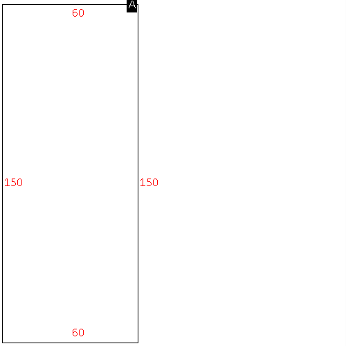 |
| Label |
Description |
Base SF |
Total SF |
| A |
WHSE |
9000.00 |
9000.00 |
|
|
|
|
|
| Map Acres |
19.32 |
| Tax District Note |
15 - C/SW/CROSSROADS FD |
| Present-Use Info |
COMMERICAL |
| Zoning Code |
RA20 |
| Zoning Desc |
RESIDENTIAL 20000 SF LUC |
|
| Total Improvements Valuation
|
*Total Improvements Full Market Value $
|
**Total Improvements Assessed Value
|
388,517
|
388,517
|
*
Note - Market Value effective Date equal January 1, 2024, date of County’s most recent General
Reappraisal
** Note - If Assessed Value not equal Market Value then variance
resulting from formal appeal procedure |
|
| Land
Value Detail (Effective Date January 1, 2024, date
of County’s most recent General Reappraisal) |
Land
Full Value (LFV) $
|
Land
Present-Use Value (PUV) $ **
|
Land
Total Assessed Value $
|
62,331
|
36,731
|
36,731
|
| **
Note: If PUV equal LMV then parcel has
not qualified for present use program |
|
| Land
Detail (Effective Date January 1, 2024, date of County’s
most recent General Reappraisal) |
Rate Type |
Rate Code |
Description |
Quantity |
AC |
0700 |
COMMERCIAL |
1.000 |
|
|
|
.000 |
AC |
5111 |
MKT OPEN LD PVD CLASS 1 |
11.200 |
LU |
5110 |
|
11.200 |
AC |
5311 |
MKT OPEN LD PVD CLASS 3 |
2.200 |
LU |
5310 |
|
2.200 |
AC |
5411 |
MKT OPEN LD PVD CLASS 4 |
1.180 |
LU |
5410 |
|
1.180 |
AC |
6111 |
MKT WOODS PVD CLASS 1 |
.320 |
LU |
6110 |
|
.320 |
AC |
6311 |
MKT WOODS PVD CLASS 3 |
1.250 |
LU |
6310 |
|
1.250 |
AC |
9500 |
SUBMERGED,RIVER,LAKE,POND |
.150 |
|
|
|
.000 |
AC |
5111 |
MKT OPEN LD PVD CLASS 1 |
.500 |
LU |
5110 |
|
.500 |
AC |
5311 |
MKT OPEN LD PVD CLASS 3 |
.700 |
LU |
5310 |
|
.700 |
AC |
6311 |
MKT WOODS PVD CLASS 3 |
.820 |
LU |
6310 |
|
.820 |
|
|
|
|
