| RB LANCASTER & SONS PROPERTIES |
| LLC |
|
| 4031 NC HWY 222E |
|
| STANTONSBURG , NC 27883 |
|
| Property
Location Address |
|
| Parcel
ID No. |
3649218500.000 |
| PIN |
3649 21 8500 000 |
| Owner ID |
1126900 |
| |
|
| Tax
District |
17 - C/SW/MOYTON FD |
| |
| Land Use Code |
50 |
| Land Use Desc |
RURAL HOMESITE |
| |
|
| Neighborhood |
8298 - STANTONSBURG_TWP |
|
| Legal
Desc |
5498 NC 58 HWY S |
| |
TR-5&6 EAGLES LD 213.92AC |
| |
|
| Deed
Year Bk/Pg |
2022 - 2961 / 326 |
| Plat
Bk/Pg |
18 / 91 |
| |
Sales
Information |
| |
| Grantor |
LANCASTER R B JR & RONALD B |
| |
LANCASTER RICHARD V & GLENN C |
| Sold
Date |
2022-05-02 |
| Sold
Amount $ |
0 |
|
| |
| Market Value $ |
2,475,203
|
| |
|
Market
Value - Land and all permanent improvements,
if any, effective January 1, 2024, date
of County’s most recent General Reappraisal
|
|
| |
|
| Assessed Value $ |
2,219,216
|
| |
If
Assessed Value not equal Market Value then
subject parcel designated as a special
class -agricultural, horticultural, or
forestland and thereby eligible for taxation
on basis of Present-Use.
|
|
|
| Year
Built |
1910 |
| Built
Use/Style |
SFR-1.0 STY |
| Grade |
D-05 / D-05 GRADE |
| * Percent
Complete |
100 |
| Heated
Area (S/F) |
1,688 |
| Fireplace
(Y/N) |
N |
| Basement
(Y/N) |
N |
| ** Bedroom(s) |
3 |
| ** Bathroom(s) |
1 Full Bath(s) 0 Half Bath(s) |
| *** Multiple
Improvements |
003 |
*
Note - As of January 1
*
* Note - Bathroom(s), Bedroom(s), shown for description
only
* * * Note - If multiple improvements equal “MLT” then
parcel includes additional major improvements |
|
| Photo |
|
No Photo for 3649218500.000
|
|
| Building
Sketch - NOTE: Sketches are updated the first day of every month. |
|
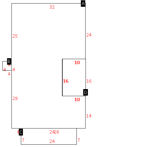
(Building 1) - Sketch for Parcel ID: 3649218500.000
NOTE: Sketches are updated the first day of every month.
 |
| Label |
Description |
Base SF |
Total SF |
| A |
SFR-1.0 STY |
1568.00 |
1568.00 |
| B |
UTILITY STG-FR |
16.00 |
.00 |
| C |
PORCH-OPEN-FR |
168.00 |
.00 |
| D |
DECK-WOOD |
160.00 |
.00 |
|
|
(Building 2) - Sketch for Parcel ID: 3649218500.000
NOTE: Sketches are updated the first day of every month.
 |
| Label |
Description |
Base SF |
Total SF |
| A |
SFR-1.0 STY |
1543.00 |
1543.00 |
| B |
PORCH-OPEN-FR |
196.00 |
.00 |
|
|
(Building 3) - Sketch for Parcel ID: 3649218500.000
NOTE: Sketches are updated the first day of every month.
 |
| Label |
Description |
Base SF |
Total SF |
| A |
SFR-1.0 STY |
1688.00 |
1688.00 |
| B |
PORCH-OPEN-FR |
333.00 |
.00 |
|
|
|
|
|
| Map Acres |
213.92 |
| Tax District Note |
17 - C/SW/MOYTON FD |
| Present-Use Info |
RURAL HOMESITE |
| Zoning Code |
AR |
| Zoning Desc |
AGRICUL-RESID 40M SF |
|
| Total Improvements Valuation
|
*Total Improvements Full Market Value $
|
**Total Improvements Assessed Value
|
2,035,258
|
2,035,258
|
*
Note - Market Value effective Date equal January 1, 2024, date of County’s most recent General
Reappraisal
** Note - If Assessed Value not equal Market Value then variance
resulting from formal appeal procedure |
|
| Land
Value Detail (Effective Date January 1, 2024, date
of County’s most recent General Reappraisal) |
Land
Full Value (LFV) $
|
Land
Present-Use Value (PUV) $ **
|
Land
Total Assessed Value $
|
439,945
|
183,958
|
183,958
|
| **
Note: If PUV equal LMV then parcel has
not qualified for present use program |
|
| Land
Detail (Effective Date January 1, 2024, date of County’s
most recent General Reappraisal) |
Rate Type |
Rate Code |
Description |
Quantity |
AC |
5010 |
RURAL HOMESITE PAVED |
3.000 |
|
|
|
.000 |
AC |
5111 |
MKT OPEN LD PVD CLASS 1 |
3.260 |
LU |
5110 |
|
3.260 |
AC |
5211 |
MKT OPEN LD PVD CLASS 2 |
121.170 |
LU |
5210 |
|
121.170 |
AC |
5411 |
MKT OPEN LD PVD CLASS 4 |
10.940 |
LU |
5410 |
|
10.940 |
AC |
5511 |
MKT OPEN LD PVD CLASS 5 |
2.600 |
LU |
5510 |
|
2.600 |
AC |
5611 |
MKT OPEN LD PVD CLASS 6 |
10.570 |
LU |
5610 |
|
10.570 |
AC |
6111 |
MKT WOODS PVD CLASS 1 |
2.950 |
LU |
6110 |
|
2.950 |
AC |
6211 |
MKT WOODS PVD CLASS 2 |
25.060 |
LU |
6210 |
|
25.060 |
AC |
6411 |
MKT WOODS PVD CLASS 4 |
34.370 |
LU |
6410 |
|
34.370 |
|
|
|
|
