| KENLY COURT NORTH CAROLINA |
| LIMITED PARTNERSHIP |
|
| 1515 MOCKINGBIRD LANE ST 1010 |
|
| CHARLOTTE , NC 28209 |
|
| Property
Location Address |
|
| Parcel
ID No. |
2667054770.000 |
| PIN |
2667 05 4770 000 |
| Owner ID |
1036691 |
| |
|
| Tax
District |
28 - C/CIKN-KENLY |
| |
| Land Use Code |
60 |
| Land Use Desc |
GARDEN APARTMENT |
| |
|
| Neighborhood |
8287 - SPRING_HILL |
|
| Legal
Desc |
6010 WHITLEY DR |
| |
6 APTS PHASE 2 7T 2.76AC |
| |
|
| Deed
Year Bk/Pg |
2007 - 2289 / 66 |
| Plat
Bk/Pg |
/ |
| |
Sales
Information |
| |
| Grantor |
|
| |
|
| Sold
Date |
0--0 |
| Sold
Amount $ |
0 |
|
| |
| Market Value $ |
1,004,351
|
| |
|
Market
Value - Land and all permanent improvements,
if any, effective January 1, 2024, date
of County’s most recent General Reappraisal
|
|
| |
|
| Assessed Value $ |
1,004,351
|
| |
If
Assessed Value not equal Market Value then
subject parcel designated as a special
class -agricultural, horticultural, or
forestland and thereby eligible for taxation
on basis of Present-Use.
|
|
|
| Year
Built |
1979 |
| Built
Use/Style |
APARTMENT- GARDEN |
| Grade |
C / C GRADE |
| * Percent
Complete |
100 |
| Heated
Area (S/F) |
4,050 |
| Fireplace
(Y/N) |
N |
| Basement
(Y/N) |
N |
| ** Bedroom(s) |
0 |
| ** Bathroom(s) |
0 Full Bath(s) 0 Half Bath(s) |
| *** Multiple
Improvements |
006 |
*
Note - As of January 1
*
* Note - Bathroom(s), Bedroom(s), shown for description
only
* * * Note - If multiple improvements equal “MLT” then
parcel includes additional major improvements |
|
| Photo |
Photo 1
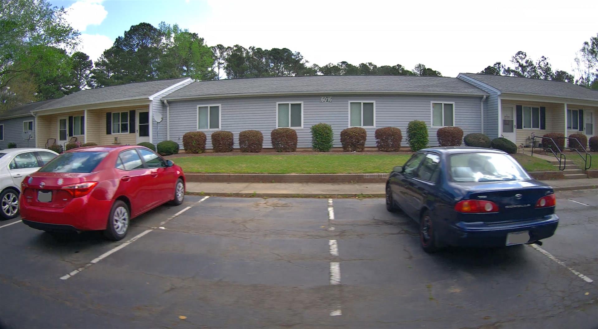 Photo 2
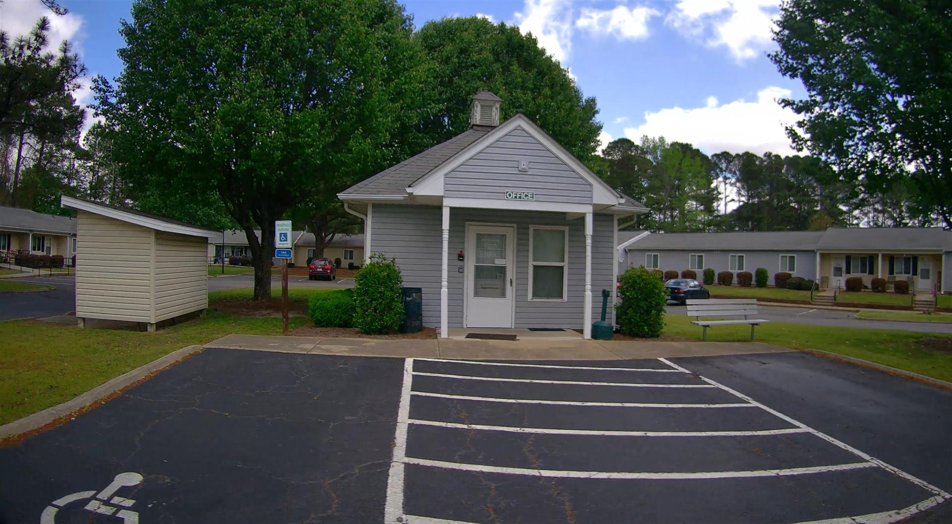 Photo 1
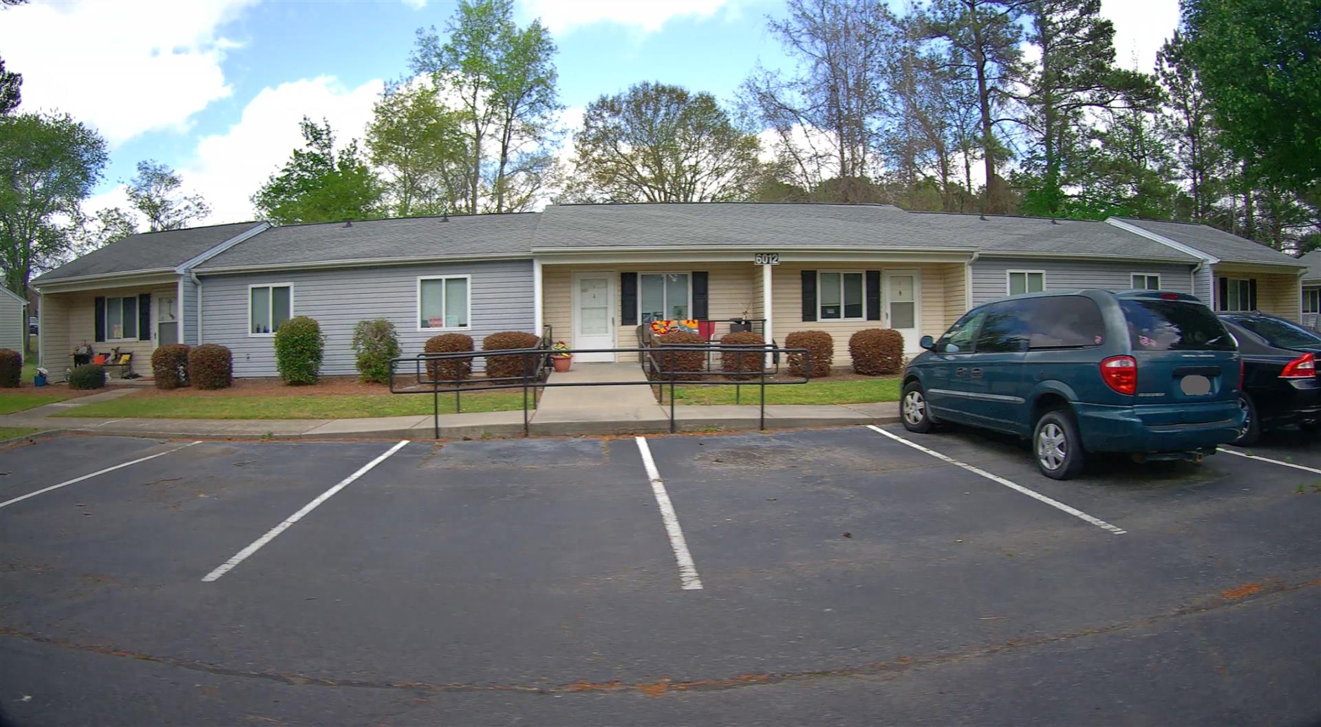 Photo 1
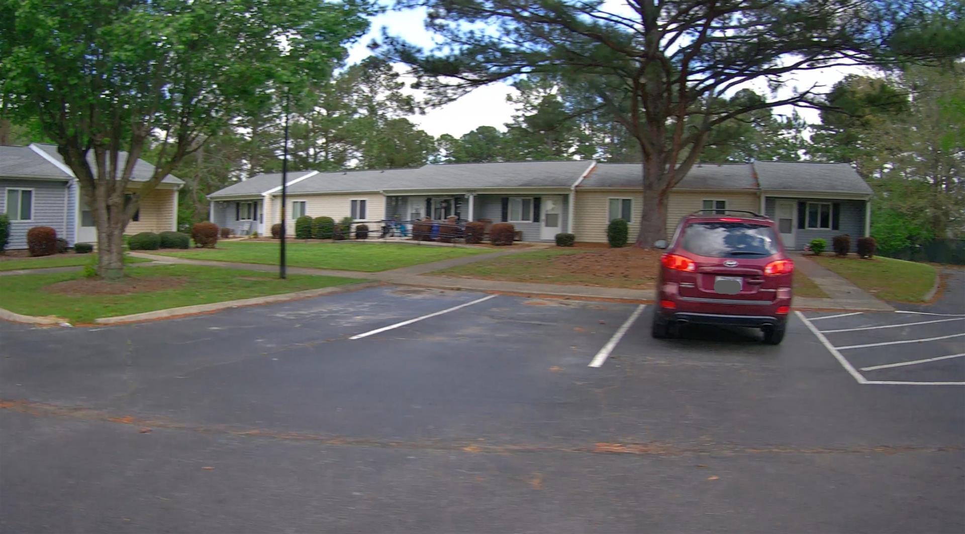 Photo 1
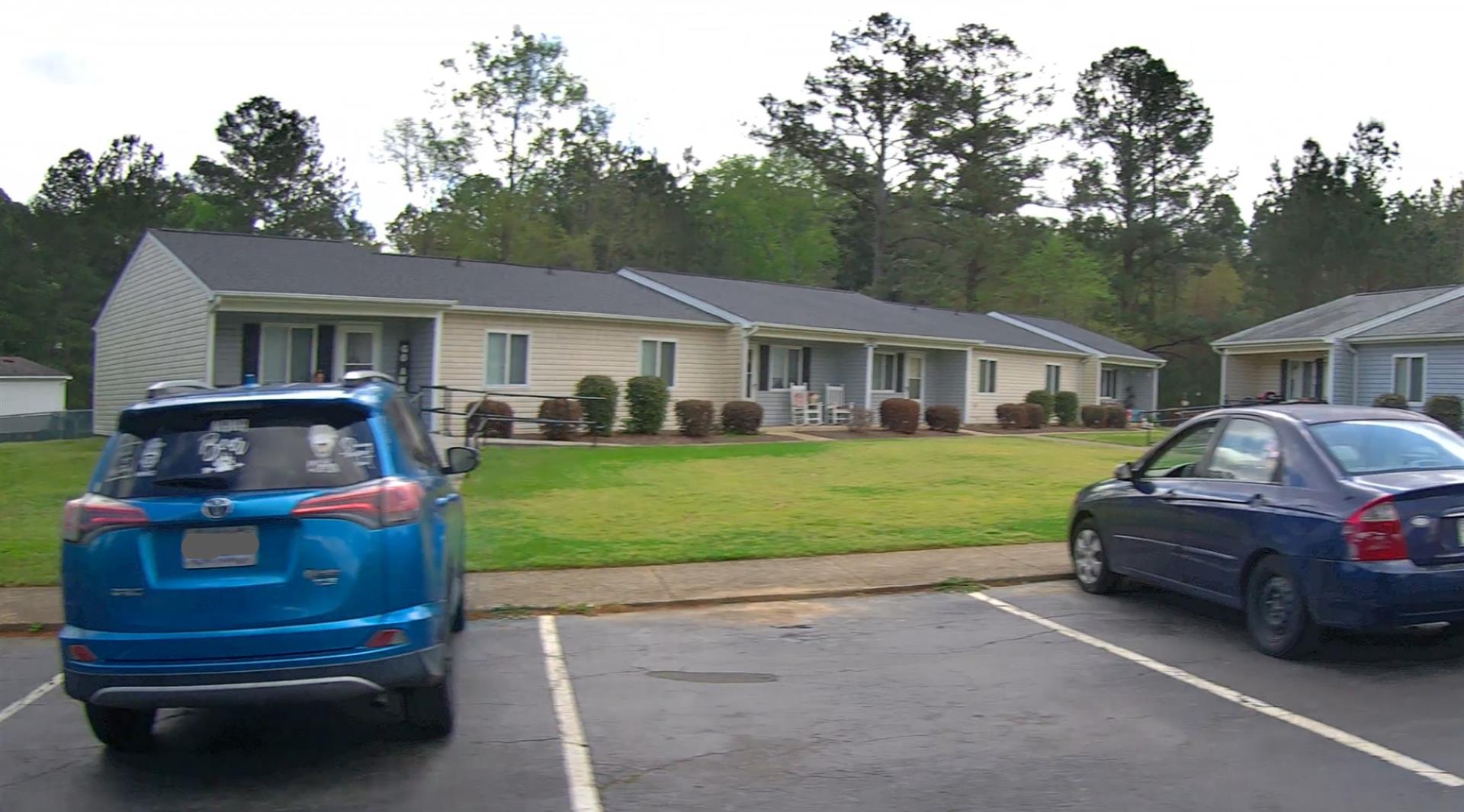 Photo 1
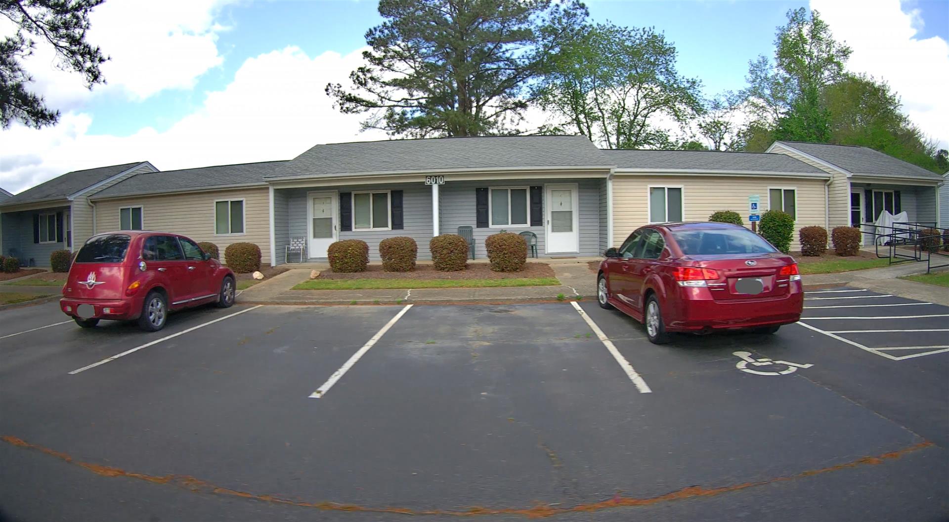 Photo 1

|
|
| Building
Sketch - NOTE: Sketches are updated the first day of every month. |
|
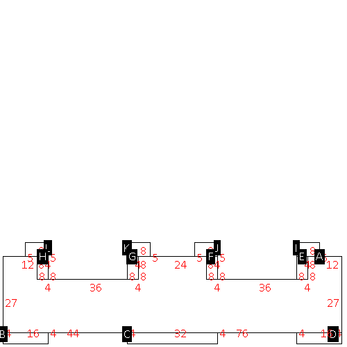
(Building 1) - Sketch for Parcel ID: 2667054770.000
NOTE: Sketches are updated the first day of every month.
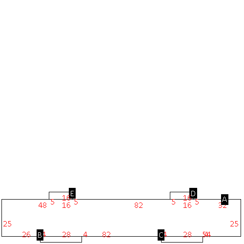 |
| Label |
Description |
Base SF |
Total SF |
| A |
APT-GARDEN |
4050.00 |
4050.00 |
| B |
PORCH-OPEN-MAS |
112.00 |
.00 |
| C |
PORCH-OPEN-MAS |
112.00 |
.00 |
| D |
PATIO-CONC |
80.00 |
.00 |
| E |
PATIO-CONC |
80.00 |
.00 |
|
|
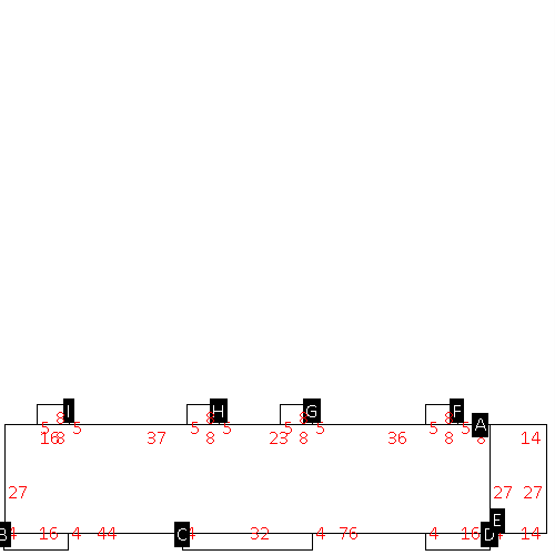
(Building 2) - Sketch for Parcel ID: 2667054770.000
NOTE: Sketches are updated the first day of every month.
 |
| Label |
Description |
Base SF |
Total SF |
| A |
APT-GARDEN |
3240.00 |
3240.00 |
| B |
PORCH-OPEN-MAS |
64.00 |
.00 |
| C |
PORCH-OPEN-MAS |
128.00 |
.00 |
| D |
PORCH-OPEN-MAS |
64.00 |
.00 |
| E |
PATIO-CONC |
40.00 |
.00 |
| F |
PATIO-CONC |
40.00 |
.00 |
| G |
PATIO-CONC |
40.00 |
.00 |
| H |
PATIO-CONC |
40.00 |
.00 |
|
|
(Building 3) - Sketch for Parcel ID: 2667054770.000
NOTE: Sketches are updated the first day of every month.
 |
| Label |
Description |
Base SF |
Total SF |
| A |
APT-GARDEN |
3240.00 |
3240.00 |
| B |
PORCH-OPEN-MAS |
64.00 |
.00 |
| C |
PORCH-OPEN-MAS |
128.00 |
.00 |
| D |
PORCH-OPEN-MAS |
64.00 |
.00 |
| E |
PATIO-CONC |
40.00 |
.00 |
| F |
PATIO-CONC |
40.00 |
.00 |
| G |
PATIO-CONC |
40.00 |
.00 |
| H |
PATIO-CONC |
40.00 |
.00 |
|
|
(Building 4) - Sketch for Parcel ID: 2667054770.000
NOTE: Sketches are updated the first day of every month.
 |
| Label |
Description |
Base SF |
Total SF |
| A |
APT-GARDEN |
3240.00 |
3240.00 |
| B |
PORCH-OPEN-MAS |
64.00 |
.00 |
| C |
PORCH-OPEN-MAS |
128.00 |
.00 |
| D |
PORCH-OPEN-MAS |
64.00 |
.00 |
| E |
PATIO-CONC |
40.00 |
.00 |
| F |
PATIO-CONC |
40.00 |
.00 |
| G |
PATIO-CONC |
40.00 |
.00 |
| H |
PATIO-CONC |
40.00 |
.00 |
|
|
(Building 5) - Sketch for Parcel ID: 2667054770.000
NOTE: Sketches are updated the first day of every month.
 |
| Label |
Description |
Base SF |
Total SF |
| A |
APT-GARDEN |
2664.00 |
2664.00 |
| B |
PORCH-OPEN-MAS |
64.00 |
.00 |
| C |
PORCH-OPEN-MAS |
128.00 |
.00 |
| D |
PORCH-OPEN-MAS |
64.00 |
.00 |
| E |
UTILITY STG-FR |
32.00 |
.00 |
| F |
UTILITY STG-FR |
32.00 |
.00 |
| G |
UTILITY STG-FR |
32.00 |
.00 |
| H |
UTILITY STG-FR |
32.00 |
.00 |
| I |
PATIO-CONC |
40.00 |
.00 |
| J |
PATIO-CONC |
40.00 |
.00 |
| K |
PATIO-CONC |
40.00 |
.00 |
| L |
PATIO-CONC |
40.00 |
.00 |
|
|
(Building 6) - Sketch for Parcel ID: 2667054770.000
NOTE: Sketches are updated the first day of every month.
 |
| Label |
Description |
Base SF |
Total SF |
| A |
APT-GARDEN |
3240.00 |
3240.00 |
| B |
PORCH-OPEN-MAS |
64.00 |
.00 |
| C |
PORCH-OPEN-MAS |
128.00 |
.00 |
| D |
PORCH-OPEN-MAS |
64.00 |
.00 |
| E |
UTILITY STG-FR |
378.00 |
.00 |
| F |
PATIO-CONC |
40.00 |
.00 |
| G |
PATIO-CONC |
40.00 |
.00 |
| H |
PATIO-CONC |
40.00 |
.00 |
| I |
PATIO-CONC |
40.00 |
.00 |
|
|
|
|
|
| Map Acres |
2.76 |
| Tax District Note |
28 - C/CIKN-KENLY |
| Present-Use Info |
GARDEN APARTMENT |
| Zoning Code |
RA20 |
| Zoning Desc |
RESIDENTIAL 20000 SF LUC |
|
| Total Improvements Valuation
|
*Total Improvements Full Market Value $
|
**Total Improvements Assessed Value
|
935,351
|
935,351
|
*
Note - Market Value effective Date equal January 1, 2024, date of County’s most recent General
Reappraisal
** Note - If Assessed Value not equal Market Value then variance
resulting from formal appeal procedure |
|
| Land
Value Detail (Effective Date January 1, 2024, date
of County’s most recent General Reappraisal) |
Land
Full Value (LFV) $
|
Land
Present-Use Value (PUV) $ **
|
Land
Total Assessed Value $
|
69,000
|
69,000
|
69,000
|
| **
Note: If PUV equal LMV then parcel has
not qualified for present use program |
|
| Land
Detail (Effective Date January 1, 2024, date of County’s
most recent General Reappraisal) |
Rate Type |
Rate Code |
Description |
Quantity |
AC |
0500 |
MULTI-FAMILY |
2.760 |
|
|
|
.000 |
|
|
|
|
